Glenbrook

In 1947, the L&N ran the Clover Fork Branch up to what was called Glenbrook KY (read about it here).  The reason was that Stonega Coal and Coke Company had decided to dip into the Wallins coal seam here.  They constructed five dated adits as they dug into the coal.  This one < at 36.88345, -82.91997> is representative of the three on the eastern part of this complex (it’s not really open…there’s a huge, rusty fuel tank stuffed into the adit to deter visitors):
OLYMPUS DIGITAL CAMERA


Right at these adits is a group of buildings…a service area for mining equipment, a power building, showers and lockers for the miners.  There were also offices installed sometime later, since they put in dropped ceilings to cover the original high ones with the pulleys that helped miners get out of their work clothes before showering.
On the west side of this particular complex are two more adits, also dated 1947:

OLYMPUS DIGITAL CAMERA


Here’s a long view of what was once a sorting/loading area:

OLYMPUS DIGITAL CAMERA


And this possibly was once a very early exploratory mine, now bermed in.  You can easily tell is was once a mine, though:

OLYMPUS DIGITAL CAMERA


This whole old mining area is in foreclosure.  It’s scheduled to be completely bulldozed early in 2015.  We took plenty of pictures.  We’ll remember it.

Dent (not Dante) Yard

Back in 1945, Blue Diamond Coal Company, out of Knoxville TN, opened up the Leatherwood mine complex, about ten miles up Leatherwood Creek from the North Fork of the Kentucky River.  At the same time, the L&N ran a spur from their main line on the north side of the river to the mines and, in order to handle the vast amount of coal coming out of Leatherwood, the railroad also built a breakdown yard a little further up the river toward Hazard, near a town called Dent (it’s gone now).  At the intersection of the main line and the spur (at 37.12946, -83.08649, nearest Google Earth locator is Cornettsville KY), a complex was built to service the locomotives.  It included a turntable (see it here), a pumping station to bring water up from the river to a tank used to service the steam locomotives, and various other buildings.  The remains of the turntable are still visible:
OLYMPUS DIGITAL CAMERA


To get a sense of scale, that’s my buddy standing over on the other side of the foundation (he’s dressed in white).  The remnants of the pumping station and various other buildings are still there, also.  This yard operation only lasted about a decade or so.
This is looking toward where Dent Yard once was:
OLYMPUS DIGITAL CAMERA


But one thing had me puzzled.  Just a short way down the river from the main trestle, I saw these:
OLYMPUS DIGITAL CAMERA


Another bridge, an old style bridge, didn’t seem to fit.  There was no need for a wye here and these piers seem to predate 1945.  It took a bit of researching, but I located a map of Perry County from 1937 and got my information.  The L&N came into Hazard in 1912 and spread out to service both timber operations and small coal mines.  In 1937, there was already a main line in place here.  I suspect this bridge carried a light rail line, possibly for timber (logging was certainly taking place around Leatherwood Creek in that time period…small coal operations, too), across the river to the main line.  How long it was viable, I have no idea.
Oh, that orange pipe crossing the river comes from a gas well across the tracks on the left.

Another Anonymous Tunnel

OLYMPUS DIGITAL CAMERA


I opted to show the approach and the tunnel because the tunnel isn’t particularly interesting.  No date, but it was constructed in the 1940s when the L&N opened up the Leatherwood Branch (KY) to bring out coal from the massive Blue Diamond Mine complex.  This portal is at 37.09080, -83.10304.  The tunnel, a little over .25 mile long, curves through a ridge at a bend of Leatherwood Creek. The track here actually dates to 1940, mostly Bethlehem Steel rail.  There are two trestles here: the closest is timber construction and the far one is deck girder, with no maker name/date plate.  It didn’t appear to have ever had such a plate.

This is looking easterly.  The track curves to the right practically at the portal.  The line then goes on to what is now a partial wye over the North Fork of the Kentucky River down at the end of Dent Yard.

Kingsport Yard, 1976

csxengine

I didn’t have any particular interest in trains in ’76, but I live close to the yard, so I always am wandering around with a camera.  The guy on the left was using a remote unit to operate this engine.
Even though I live four blocks away, people still ask me if the noise from the trains bothers me.  Huh, I was raised in Morristown just across the street from a switch and freight yard.  What noise?

Lone Mountain hub

OLYMPUS DIGITAL CAMERA


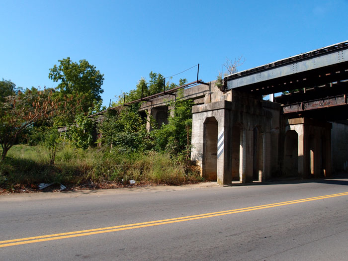
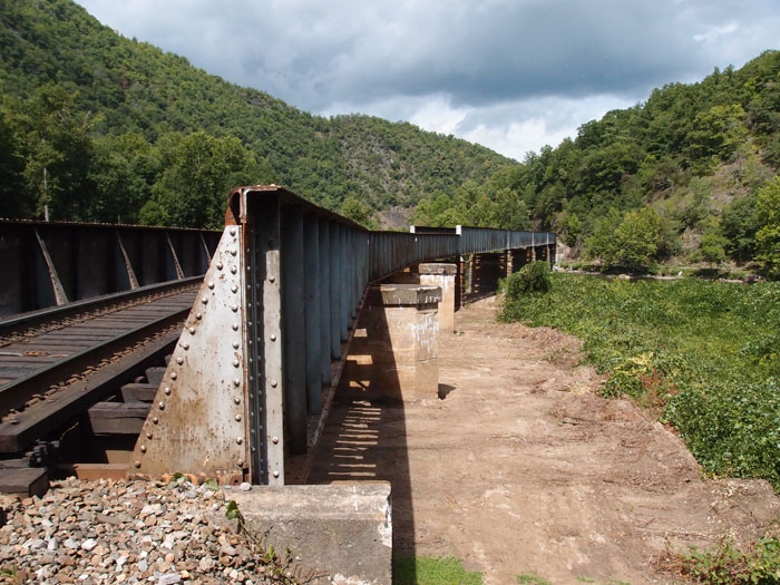
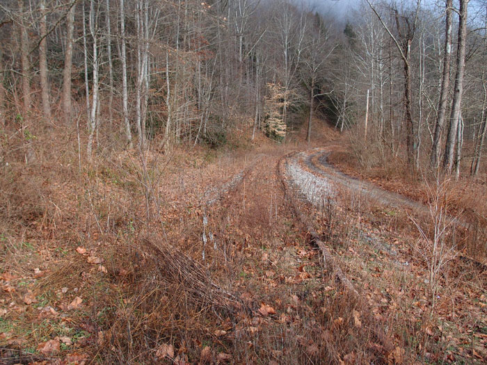
We were coming down Lone Mountain Road in Claiborne County TN when this caught my eye.  The lower track is an active N&S line, the upper track is very old steel and long disused.  As I was taking this picture, a man approached and wanted to know what I was doing.  I told  him I was interested in this old jib crane (called a derrick by the railroad) and asked him if he knew anything about it.  He tended to be a bit confrontational until I explained that I was from Kingsport and that I  had an interest in old railroad equipment and trackage.  He loosened up a bit and told me he owned the land here, but the jib crane still belonged to the railroad.  He said, “this old track was put down in 1878 to load granite and marble from a quarry up the tracks.”  We chatted for a bit more and I moved off, since it turned out that his wife and daughter were a little further down the track (for some reason) and he had gotten suspicious when he saw me exit my car and come in that direction with something in my hand (my camera).  Did I mention he was carrying?
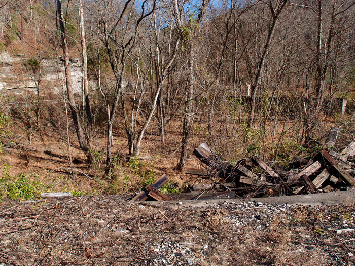
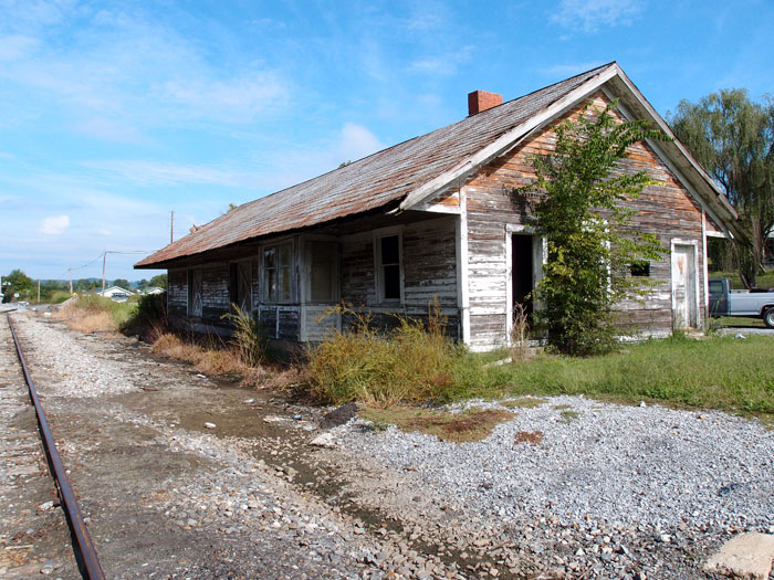
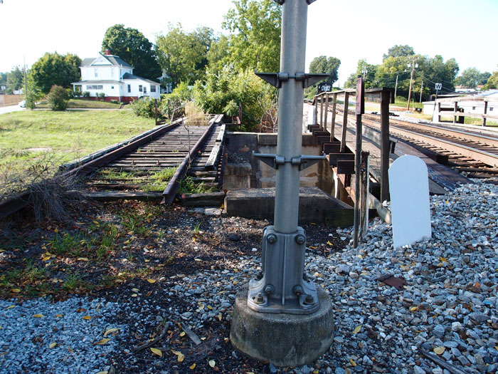
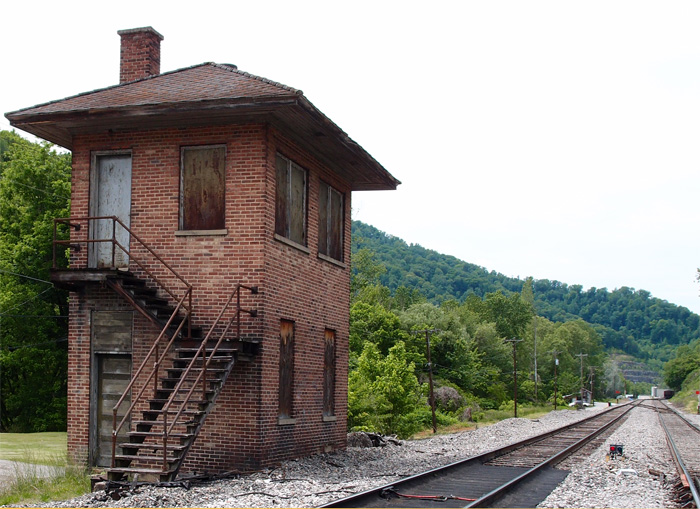
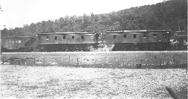
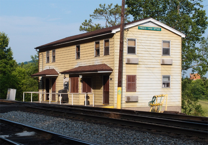
I was rather amazed at the date, so I made an audio note of it and we moved on, looking for Lone Mountain elementary school, which was right in this neighborhood.  However, we encountered Dan Beeler, who told us the school had burned down eight years before.  He did confirm the dating of the railroad, though, and said the foundation of the old depot was still there, behind the still existing old store that had been a post office for Lone Mountain.   He also informed us that Lone Mountain was quite a hub of activity in the day, with trains stopping to load pulpwood, minerals, livestock and the like.  Here’s what the foundation of the old station looks like today:

OLYMPUS DIGITAL CAMERA


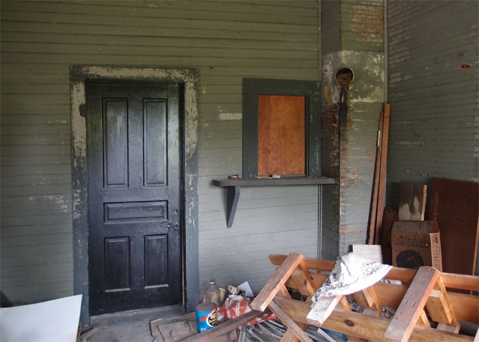
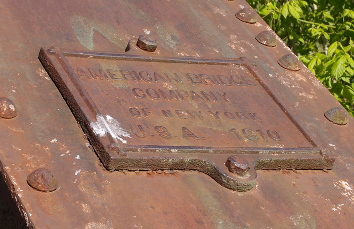
This is looking west.  The track here ends just a little bit beyond the end of the foundation…there’s a cross-rail block there.  The steel in this track varies from a 1901 Scranton to a 1903 Carnegie.

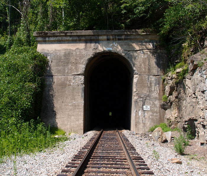
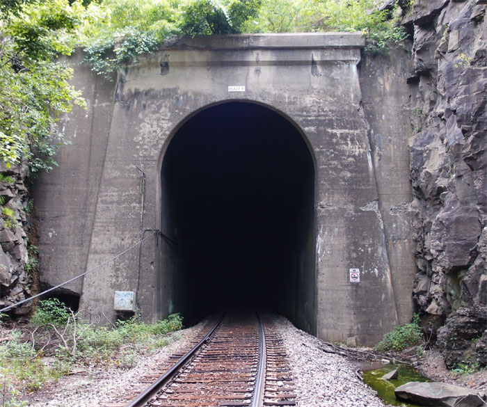
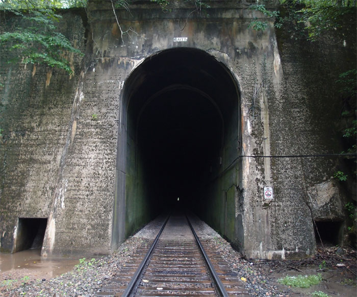
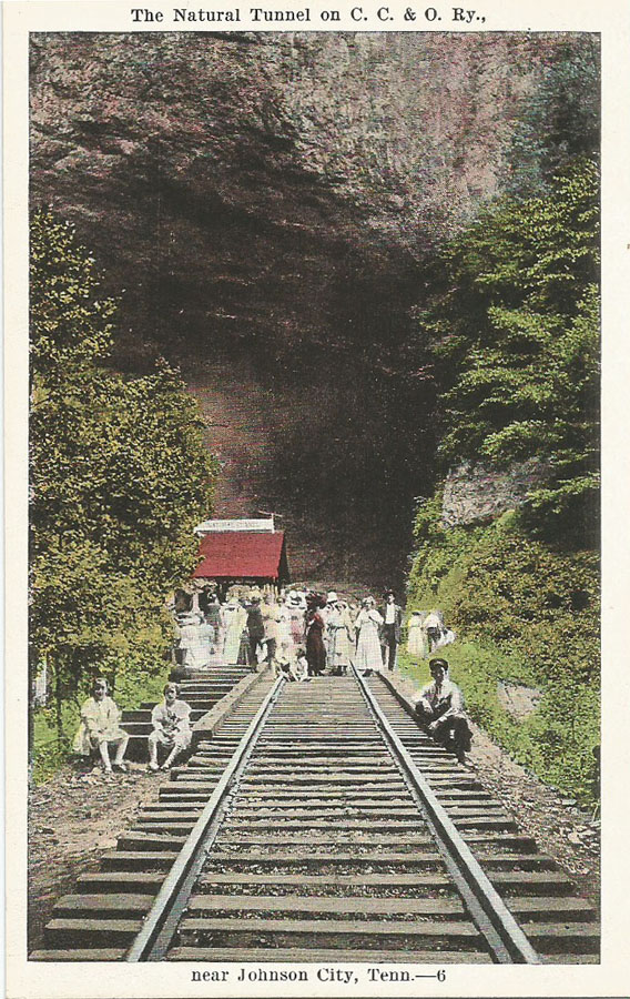
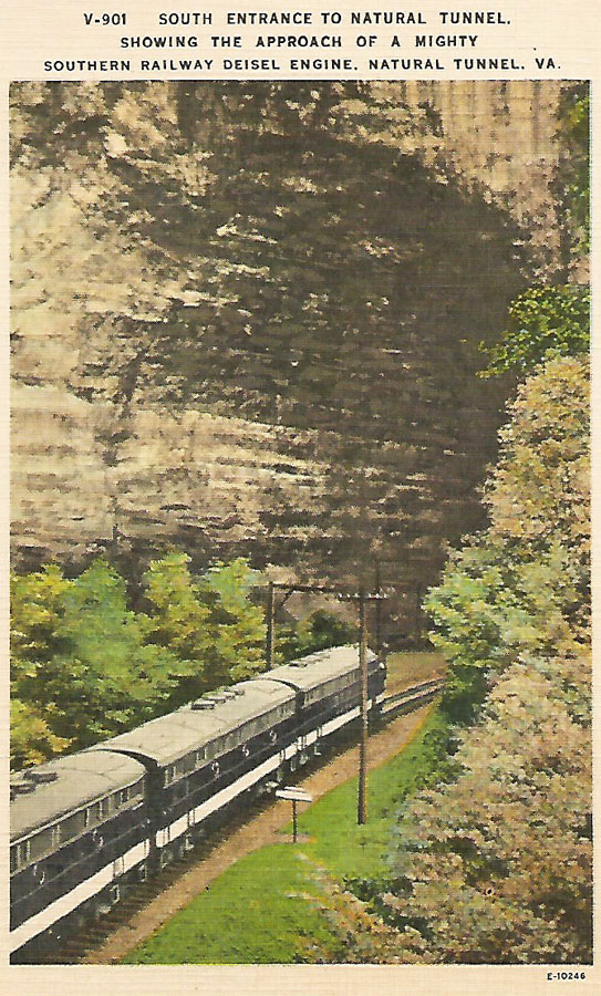
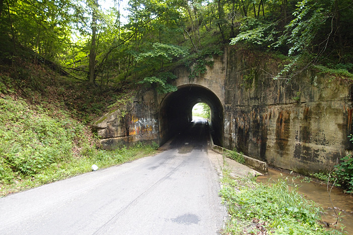
So, I had a puzzle. Dan Beeler told us the granite and marble (Tennessee marble, not “real” marble) came from a quarry in Springdale, about 4 miles to the east.  I carefully checked Google Earth to find any remnants of a railbed in that direction and couldn’t find any…then, it suddenly all clicked.  I’d been in the area before documenting the three tunnels on the old Knoxville, Cumberland Gap and Louisville Railroad.  The old stories handed down to the gentlemen we talked to were giving a date a decade or so too early.  This was the old K, CG & L line and probably came through here about 1888.  This was the company that managed to totally screw up the first digging of the tunnel at Cumberland Gap.  They also managed to off a number of important Knoxville personages on their very first run when the locomotive went off a trestle at Flat Gap.  This railroad company was as short on luck as it was on money.

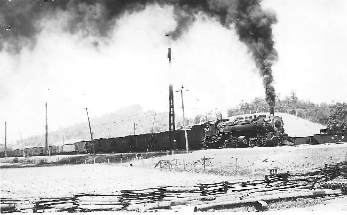
My feeling is that the railroad came through and built the spur to the jib crane and down to the station.  The quarrymen (not the Beatles) and others would haul the product by wagon down to the railroad where it would be loaded onto freight cars for a trip to Morristown, Knoxville, or, eventually, to Middlesboro.  Everyone was hot for Middlesboro in that time, since quality iron had been discovered in the area.  Flash in the pan, as it turned out.

If anyone has more information on this or wants to tell me I’m all mouth and no trousers, please make a comment.

Imboden

imboden


In the late 1880s, Gen. John D. Imboden, late of the Army of the South, working for the Tinsalia Company, helped convince a bunch of rich Northerners of the great potential for iron and coal in Southwest, by God, Virginia.  However, it wasn’t until around 1903 that the Imboden Coal Company lured the Virginia Coal and Iron Company into running a line up Pigeon Creek (which goes under these trestles) to extract coal from ICC’s mines.  This is one of three former double line trestles over the Pigeon that we saw on a trip up this line.  The line on the left is active, sort of;  the trestle on the right has been converted to auto and foot traffic.  The curve to the right just beyond the converted trestle heads up to a former coal mine.
Note:  the ties on the right trestle are rotting.

Imboden is between Appalachia and Exeter.

Mohawk Station


OLYMPUS DIGITAL CAMERA


This is old Mohawk station, now derelict.  The line in front is booted off.   Here’s a look inside what may have been the ticket office/waiting room:

OLYMPUS DIGITAL CAMERA


About 2,000 feet to the east of this station is the contemporary Lick Creek Bridge, a truss/deck girder combo.

OLYMPUS DIGITAL CAMERA


This is looking west, back toward Mohawk.  On November 8, 1861, Union sympathizers burned the bridge that was here (the bridges were made of timber then).  It was part of a effort by the “Bridge Burners” to take down the 9 bridges between Bristol and Bridgeport AL.  They succeeded, but many paid the ultimate price.
The date plates on this bridge have been chiseled off…thanks, vandals.

Triple Overpass

OLYMPUS DIGITAL CAMERA


This triple overpass is over West Summer Street in Greeneville TN.  This bridge closest to us is a dead siding, no longer connected to the main line.

Here’s what it looks like to the left:
OLYMPUS DIGITAL CAMERA


And here we are up top.  The dead siding is on the left, the main N&S line is on the right.
OLYMPUS DIGITAL CAMERA


The third overpass is for Railroad Street:
OLYMPUS DIGITAL CAMERA


There’re even steps coming up from Summer Street to Railroad Street; although, they appear to be lightly used.
OLYMPUS DIGITAL CAMERA


CXS Pony Plate Bridge

OLYMPUS DIGITAL CAMERA


This is a multiple unit pony plate bridge over the Nolichucky River (in the background) and some privately-held land.  This is looking northwest.  The bridge is about 680′ long and belongs to CSX (old Clinchfield).   There’s a big dent on the top of the plate nearest the camera, indicating that some time in the past, something got off the tracks.  To the left of where I’m standing (36.09812, -82.44180) is the old community of Unaka Springs.

Vandals have relieved all sections of this bridge of their manufacturer’s date plates.  Boo.  Hiss.

Devon Tunnel

First it was timber that drove the railroads, narrow gauge lines, into Buchanan County VA.  The timber baron W. M. Ritter ran Shay engines and a few passenger cars along with his freight cars, the Big Sandy & Cumberland Railroad, all over Knox Creek, up the hollows and, eventually, on into Grundy.  When the N&W line took it all over in 1923, they had a problem.  N&W was standard gauge.  Shay engines can do a 6% grade, slowly, but the big non-geared wheels of the steam engines couldn’t.  The N&W opened its company coffers and rebuilt the line to reach the rich coal beds in the area.  They built a wye over the Tug Fork from the Pocahontas Main Line and constructed this tunnel, Devon Tunnel.  This north portal is at 37.52763, -82.04658.
OLYMPUS DIGITAL CAMERA


You can see in the above picture, on the left wall of the tunnel, a niche.  Apparently, there was once a manual switching unit there.  It’s all controlled now remotely.  Here’s a better look at the mechanism.
OLYMPUS DIGITAL CAMERA


And, my favorite picture, looking out of the portal to the deck girders forming the wye over the Tug Fork.

OLYMPUS DIGITAL CAMERA


On the other side, about 1700′ back, is the south portal, a little more worse for wear.  The date on both is 1930.

OLYMPUS DIGITAL CAMERA

Raitt Tunnel

Raitt Tunnel was part of an expansion by the Norfolk & Western into the coal fields of Buchanan County VA.  It’s 3,700+ feet long and was completed in 1931.  This west portal is at 37.35168, -82.07228 between Big Rock and Hurley.  It’s just off the Highway 650 and, if you find the little trail down to it, it’s easy to get to.
OLYMPUS DIGITAL CAMERA


This is the east portal  (37.35408, -82.05974).  As I was walking up to it from the car, about 900 feet or so away, a sudden summer shower dropped a bucket or two of water on me.  I kept the camera dry with my cap, but I got wet.  The temperature that day in the sun was around 90 degrees and humid; the temperature at the portal was maybe 15 degrees cooler.  The second picture is taken from the portal of the mist rising from the hot tracks after the cool rain.
OLYMPUS DIGITAL CAMERA


OLYMPUS DIGITAL CAMERA

Natural Tunnel x 2

These are both early shots of Natural Tunnel, near Duffield (sort of) in Virginia.  This first one is an E.C. Kropp (Milwaukee) card.  These people are obviously celebrating something.  The sign on the red-topped building reads “Natural Tunnel”.  There are no power poles visible.  I would guess that the original picture (it was in black and white; the color was added at the printing company) dates to the first quarter of the 20th century.  Note that the railroad is listed as “C.C. & O”.
nattunneloldforweb


This is a somewhat newer card, an Asheville Post Card Company issue.  On the back:  “The Natural Tunnel, located on U.S. Highway 23, 14 miles west of Gate City, Virginia, in Scott County, is said to be the only Natural Tunnel in the world used by a railroad.  Through it the Southern Railroad has hauled many million tons of coal from the rich deposits of Southwest Virginia. (Kodachrome by Robert Suttle)”
Note that there are now power poles through the tunnel.

nattunnelnewerforweb

Smalling Bridge

This through truss, 200′ long or so, spans the Watauga River at 36.34587, -82.28300.  Luckily, whoever tried to pry the maker plate from the bridge failed – thank you.  Some antique dealers, knowing these plates have been vandalized from existing bridges, buy them anyway and sell them outside the area.  I saw one plate for sale on “American Pickers”.  Anyway, as you can see, this is a 1941 vintage structure, made with Tennessee steel.  It is located on Smalling Road, hence the name.
OLYMPUS DIGITAL CAMERA


Here’s the maker plate:

OLYMPUS DIGITAL CAMERA

Another Luten Arch

Luten Bridge Company, actually a company licensed to build Luten Arch bridges in Knoxville TN, existed in the first half of the 20th century (so long gone, now).  The earliest Luten Arch I’ve seen is up north of Pennington Gap…here.  It’s a 1918 bridge.
This one, in the Wallins Creek Community in Kentucky, spans Laurel Creek.  It’s 1929 vintage.  36.82482, -83.41535
OLYMPUS DIGITAL CAMERA


OLYMPUS DIGITAL CAMERA

Pine Mountain tunnel, west portal

Just a couple of days ago, a person who had visited this blog sent me some extremely valuable information on the Pine Mountain tunnel, bored in 1947-1948 from Jenkins KY over to the Virginia side of Pine Mountain.  The C & O was eager to open up a vast, 300 million ton, coal field just east of Pound.  The tunnel was completed in 1948 and was out of service by 1958.  The east portal, which I’ve posted before, is more or less open, if you like slogging in waders to get through to it.  This west portal, near Jenkins, was boarded up rather thoroughly (although I’ve had at least one person comment that they had gone through it).  Thanks to a photo by Chris Balthis, I know that this portal is well reinforced with concrete.  The literature indicates that this side of the mountain wasn’t as stable as the east side.  Look closely and you’ll see the inscription above the tunnel.  They did things like that then…now they just throw tunnels up and slap some concrete on them.  Hmmph, kids these days…
Anyway, I thought I’d posted this western portal.  I hadn’t.  Error corrected.
pinemtntnnlwestportal

Loyall Yard, KY

First of all, Loyall Yard is pretty big.  To get a look at it in its entirety, check Google Earth at 36.85470, -83.34902.  The yard was built by the L&N in 1920 and originally had numerous tipples, a turntable and many other structures.  The town of Loyall was once known as Shonn, which is local slang for “railroad siding” (Wikipedia).  The yard and town are protected from Cumberland River flooding by a flood wall and gate.
This structure, probably a control point of some sort is just east of Loyall Yard and is abandoned.
OLYMPUS DIGITAL CAMERA


This is the flood gate on Highway 314 (the “Jerry Chestnut Highway”) coming into Loyall (this is looking east, away from Loyall).
OLYMPUS DIGITAL CAMERA


This is a bit of Loyall Yard.  The turntable used to be over on the right, past the row of hoppers.
OLYMPUS DIGITAL CAMERA


Kentucky truss bridge

This solidly built double-track 1925 Fort Pitt Bridge Works (Pittsburgh PA) structure spans the Cumberland River just west of CSX’s Loyall Yard.  The bridge, in three sections, all box trusses (for a total of around 410′ in length), is at 36.85093, -83.36837.  It’s on an active line that winds on into Pineville.  This view is looking more or less west.  To give you a sense of scale, that’s my buddy standing in the second section on the right hand side of the tracks.
OLYMPUS DIGITAL CAMERA

Harlan KY

This is a 1910 Louisville Bridge and Iron Company pony girder just off 421 going into Harlan from the south.  CSX now owns this former Louisville & Nashville bridge over Martin’s Fork River.  Beyond the bridge you can see the huge door that closes off this area in the event of flooding (which Harlan was very susceptible to)…it’s part of a 5,000′ long wall that protects the city from rising water.  The flooding used to be worse, before they cut the three large tunnels to divert the Clover Fork River to near Baxter (see the tunnels here).
OLYMPUS DIGITAL CAMERA

Two Kentucky bridges

These two open camelback truss bridges, made by “American Bridge Co. of New York U.S.A. 1910” (the plates are the same on both…they’ve survived for 104 years!) are located on a dead L&N line that came out of Cawood KY and joined a line that came from Three-Point KY and moved on to Harlen and, probably, Baxter.  The date is right to the line. I don’t know when this line went dead, but both these bridges have been converted to pedestrian use (people walked through the wet cement, scrawled their names and initials, but a date?  Not going to happen.) This was part of the Cumberland Valley extension of the L&N that, through interchanges and leasing, heads Lynch and beyond (“To infinity and beyond!“).

This one’s just outside Cawood at 36.78422, -83.23707, looking generally west.
OLYMPUS DIGITAL CAMERA


This is the date plate on the above bridge
OLYMPUS DIGITAL CAMERA


This bridge is west of the one above.  It’s at 36.81457, -83.28791.  It’s between Chevrolet and Grays Knob KY (looking NE)
OLYMPUS DIGITAL CAMERA

Bridge over Martins Fork (KY)

This is one of three deck girder bridges over Martins Fork in Harlan County KY between Chevrolet and Cawood.  They were constructed in 1928 by the   Bethlehem Steel Company in Bethlehem PA.  This line is active CSX, but I suspect the line was put in by the L&N.  There’s a spur line, now dead, just north of here at Lenarue that parallels (sort of) Hwy 990 up to the Mary Helen mines.
This particular bridge is just off Hwy 3001 over Martins Fork.  It’s about 280′ long.
OLYMPUS DIGITAL CAMERA

Rail Real Photo Postcards

These three are real photo postcards; that is, one-off postcards made by Kodak from negatives sent in by camera owners.  The photo of the N&W hopper and the two crew cars can be dated to between 1904 and 1918, as can the shot of the steam locomotive.  The one of the crane resetting a CC&O derailment is from the 1918-1930 period.  There is no other identifying information on any of these cards.  I think they’re fascinating and I snapped them up as soon as I saw them.
n&wcrewcars


n&wsteamloco


derailment

Reedy Creek Bridge

This is original to the line, as far as I can tell.  The date (1907) is right.  This two span concrete bridge for the CSX (formerly Clinchfield) over Reedy Creek is  just off Industry Drive in Kingsport, near the new roundabout on Netherland Inn Road. (There’s a new span that takes the line over Center Street as it intersects Netherland Inn Road.  I vaguely remember the old span, which was just a two-lane overpass.  There are remnants of the old concrete structure still in place up on the line.)
This span actually no longer carries the weight of the line, it’s been strongly reinforced.  It you go by this now, you’ll see the Greenbelt covered bridge going through the left span.

reedycreekbridge

For all you pons pontis-ophiles out there

Neat, closed-to-traffic, concrete arch bridge was made by Luten Bridge of Knoxville in 1918.  This goes over Puckett Creek at Stone Creek and used to connect St. Charles Road with what was then the highway between Pennington Gap and points north.  It’s very near the intersection of Highway 421 and St. Charles Road just north of Pennington Gap. Here it is (this is looking from the highway side).  A tip of the bald guy’s cap to Lee Stone for spotting this one.

OLYMPUS DIGITAL CAMERA


Here’s the identifying plate
OLYMPUS DIGITAL CAMERA