Author: Bob Lawrence
Raitt Tunnel
Raitt Tunnel was part of an expansion by the Norfolk & Western into the coal fields of Buchanan County VA. It’s 3,700+ feet long and was completed in 1931. This west portal is at 37.35168, -82.07228 between Big Rock and Hurley. It’s just off the Highway 650 and, if you find the little trail down to it, it’s easy to get to.

This is the east portal (37.35408, -82.05974). As I was walking up to it from the car, about 900 feet or so away, a sudden summer shower dropped a bucket or two of water on me. I kept the camera dry with my cap, but I got wet. The temperature that day in the sun was around 90 degrees and humid; the temperature at the portal was maybe 15 degrees cooler. The second picture is taken from the portal of the mist rising from the hot tracks after the cool rain.

Natural Tunnel x 2
These are both early shots of Natural Tunnel, near Duffield (sort of) in Virginia. This first one is an E.C. Kropp (Milwaukee) card. These people are obviously celebrating something. The sign on the red-topped building reads “Natural Tunnel”. There are no power poles visible. I would guess that the original picture (it was in black and white; the color was added at the printing company) dates to the first quarter of the 20th century. Note that the railroad is listed as “C.C. & O”.

This is a somewhat newer card, an Asheville Post Card Company issue. On the back: “The Natural Tunnel, located on U.S. Highway 23, 14 miles west of Gate City, Virginia, in Scott County, is said to be the only Natural Tunnel in the world used by a railroad. Through it the Southern Railroad has hauled many million tons of coal from the rich deposits of Southwest Virginia. (Kodachrome by Robert Suttle)”
Note that there are now power poles through the tunnel.
Smalling Bridge
This through truss, 200′ long or so, spans the Watauga River at 36.34587, -82.28300. Luckily, whoever tried to pry the maker plate from the bridge failed – thank you. Some antique dealers, knowing these plates have been vandalized from existing bridges, buy them anyway and sell them outside the area. I saw one plate for sale on “American Pickers”. Anyway, as you can see, this is a 1941 vintage structure, made with Tennessee steel. It is located on Smalling Road, hence the name.

Here’s the maker plate:
Nora Spur
The information about the important Clinchfield Railroad Nora spur is here.
Here’s what part of it looked like a couple of years ago. This is near Nora and looking south.

I found two dates on the rails in this section: 1926 (Carnegie Steel) and 1949 (Tennessee).
Another Luten Arch
Luten Bridge Company, actually a company licensed to build Luten Arch bridges in Knoxville TN, existed in the first half of the 20th century (so long gone, now). The earliest Luten Arch I’ve seen is up north of Pennington Gap…here. It’s a 1918 bridge.
This one, in the Wallins Creek Community in Kentucky, spans Laurel Creek. It’s 1929 vintage. 36.82482, -83.41535

Pine Mountain tunnel, west portal
Just a couple of days ago, a person who had visited this blog sent me some extremely valuable information on the Pine Mountain tunnel, bored in 1947-1948 from Jenkins KY over to the Virginia side of Pine Mountain. The C & O was eager to open up a vast, 300 million ton, coal field just east of Pound. The tunnel was completed in 1948 and was out of service by 1958. The east portal, which I’ve posted before, is more or less open, if you like slogging in waders to get through to it. This west portal, near Jenkins, was boarded up rather thoroughly (although I’ve had at least one person comment that they had gone through it). Thanks to a photo by Chris Balthis, I know that this portal is well reinforced with concrete. The literature indicates that this side of the mountain wasn’t as stable as the east side. Look closely and you’ll see the inscription above the tunnel. They did things like that then…now they just throw tunnels up and slap some concrete on them. Hmmph, kids these days…
Anyway, I thought I’d posted this western portal. I hadn’t. Error corrected.

Loyall Yard, KY
First of all, Loyall Yard is pretty big. To get a look at it in its entirety, check Google Earth at 36.85470, -83.34902. The yard was built by the L&N in 1920 and originally had numerous tipples, a turntable and many other structures. The town of Loyall was once known as Shonn, which is local slang for “railroad siding” (Wikipedia). The yard and town are protected from Cumberland River flooding by a flood wall and gate.
This structure, probably a control point of some sort is just east of Loyall Yard and is abandoned.

This is the flood gate on Highway 314 (the “Jerry Chestnut Highway”) coming into Loyall (this is looking east, away from Loyall).

This is a bit of Loyall Yard. The turntable used to be over on the right, past the row of hoppers.

Kentucky truss bridge
This solidly built double-track 1925 Fort Pitt Bridge Works (Pittsburgh PA) structure spans the Cumberland River just west of CSX’s Loyall Yard. The bridge, in three sections, all box trusses (for a total of around 410′ in length), is at 36.85093, -83.36837. It’s on an active line that winds on into Pineville. This view is looking more or less west. To give you a sense of scale, that’s my buddy standing in the second section on the right hand side of the tracks.

Harlan KY
This is a 1910 Louisville Bridge and Iron Company pony girder just off 421 going into Harlan from the south. CSX now owns this former Louisville & Nashville bridge over Martin’s Fork River. Beyond the bridge you can see the huge door that closes off this area in the event of flooding (which Harlan was very susceptible to)…it’s part of a 5,000′ long wall that protects the city from rising water. The flooding used to be worse, before they cut the three large tunnels to divert the Clover Fork River to near Baxter (see the tunnels here).

Two Kentucky bridges
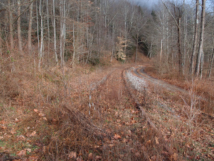
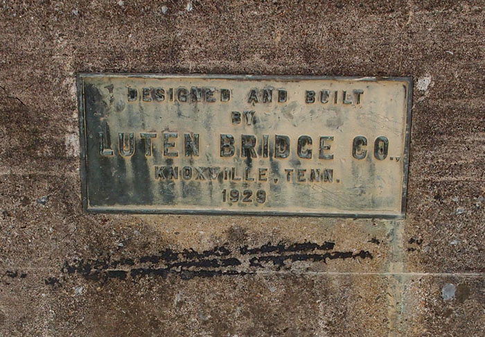
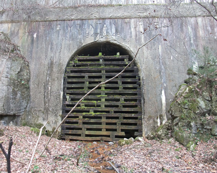
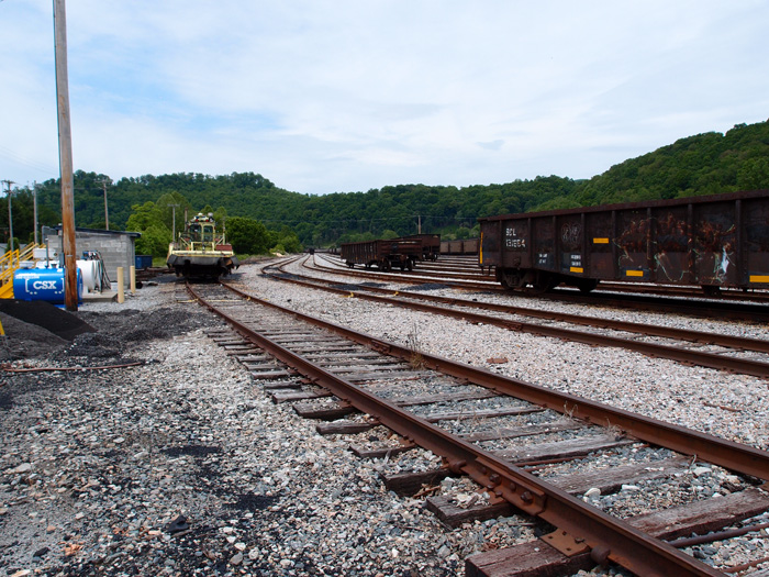
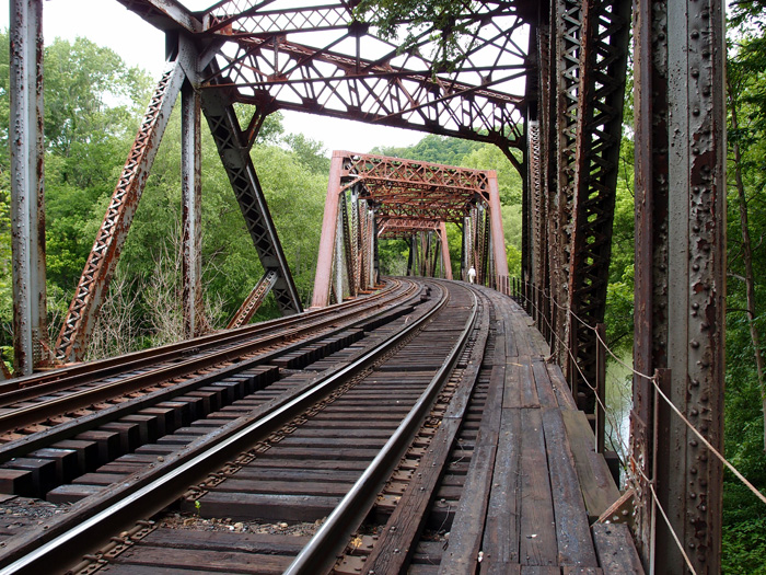
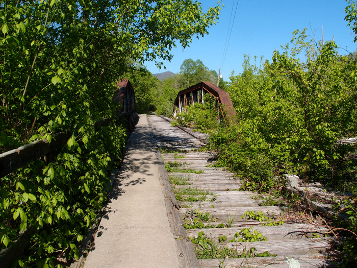
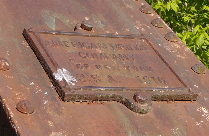
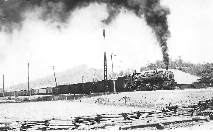
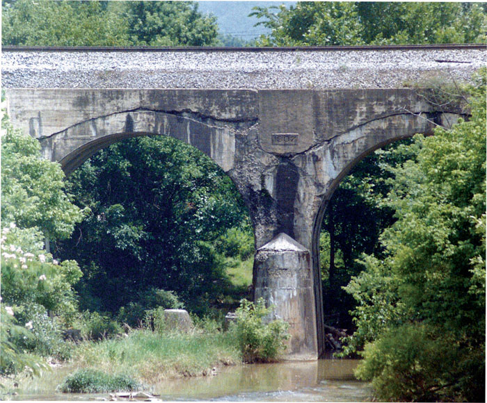
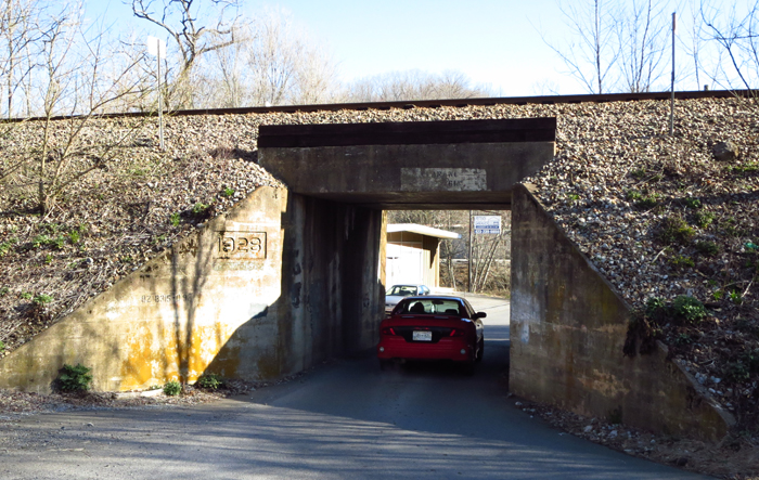
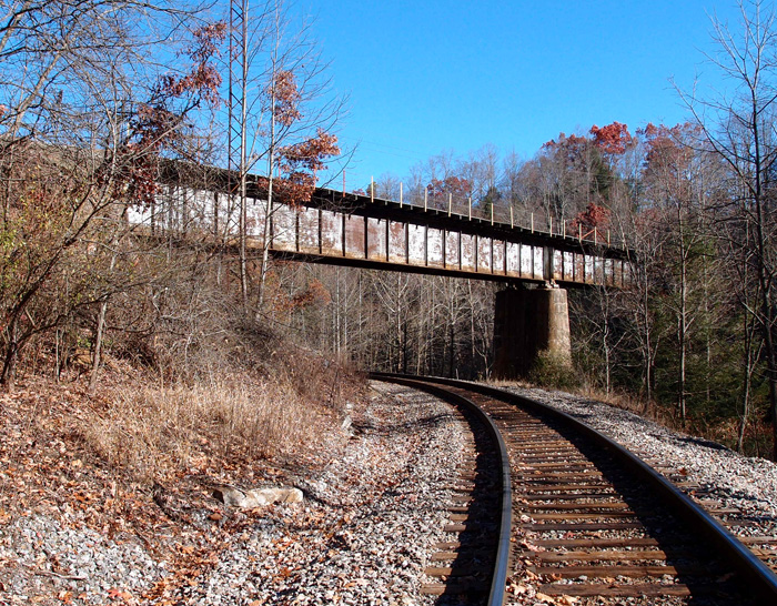
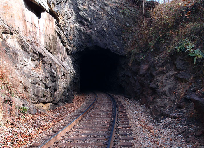
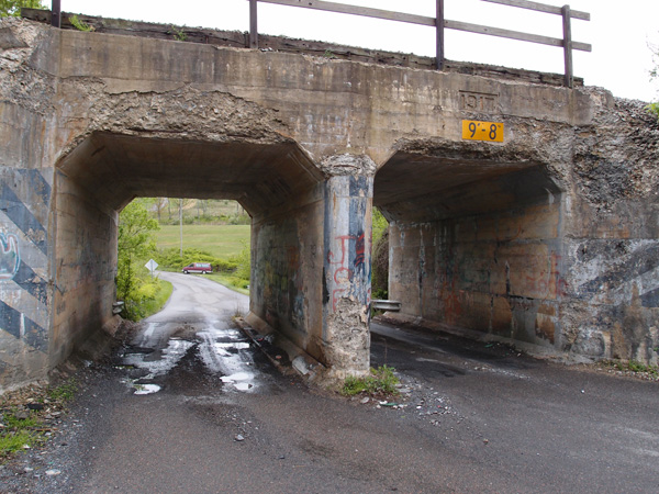
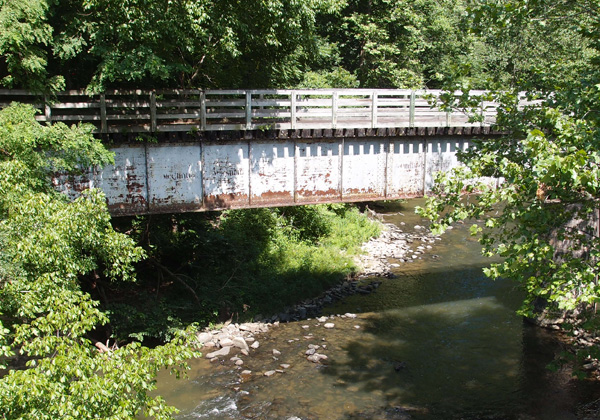
These two open camelback truss bridges, made by “American Bridge Co. of New York U.S.A. 1910” (the plates are the same on both…they’ve survived for 104 years!) are located on a dead L&N line that came out of Cawood KY and joined a line that came from Three-Point KY and moved on to Harlen and, probably, Baxter. The date is right to the line. I don’t know when this line went dead, but both these bridges have been converted to pedestrian use (people walked through the wet cement, scrawled their names and initials, but a date? Not going to happen.) This was part of the Cumberland Valley extension of the L&N that, through interchanges and leasing, heads Lynch and beyond (“To infinity and beyond!“).
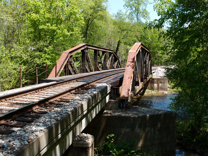
This one’s just outside Cawood at 36.78422, -83.23707, looking generally west.

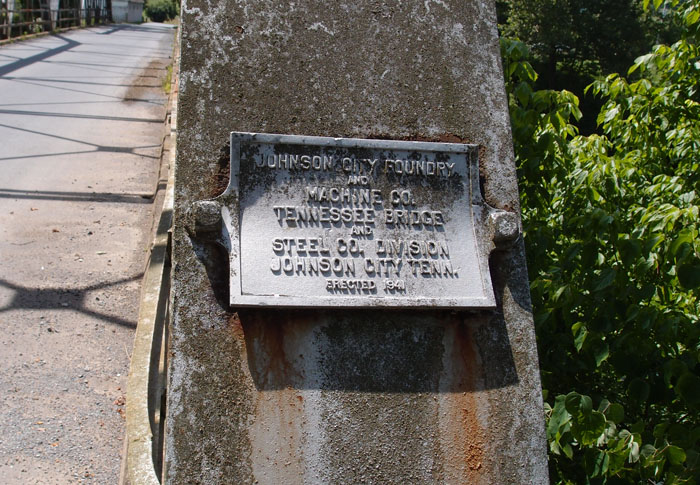
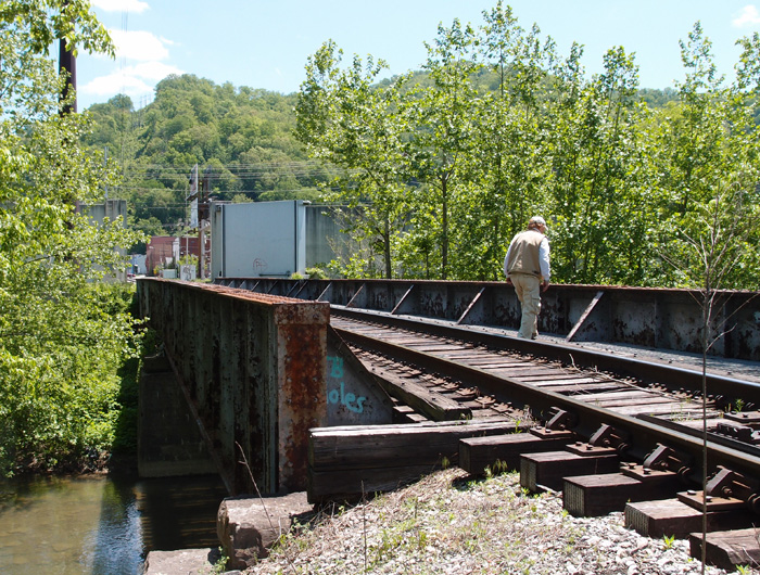
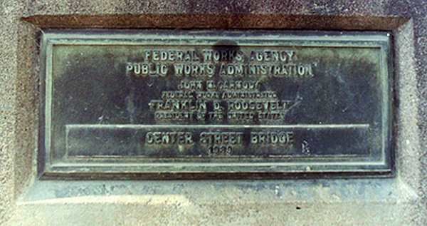
This is the date plate on the above bridge

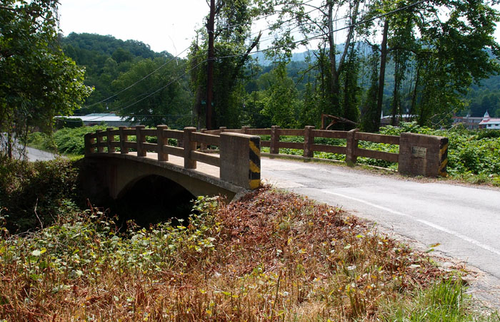
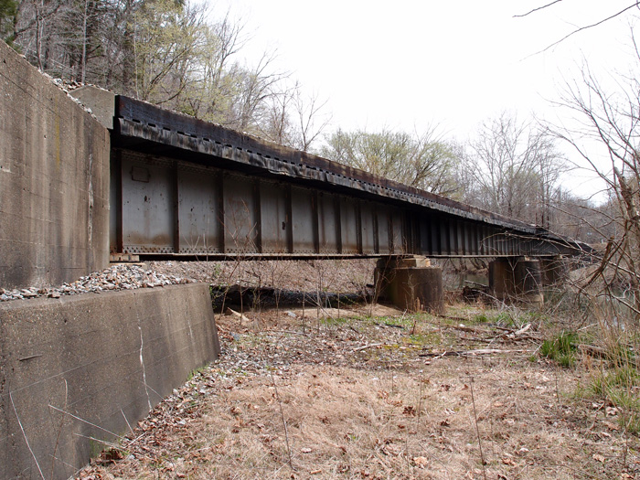
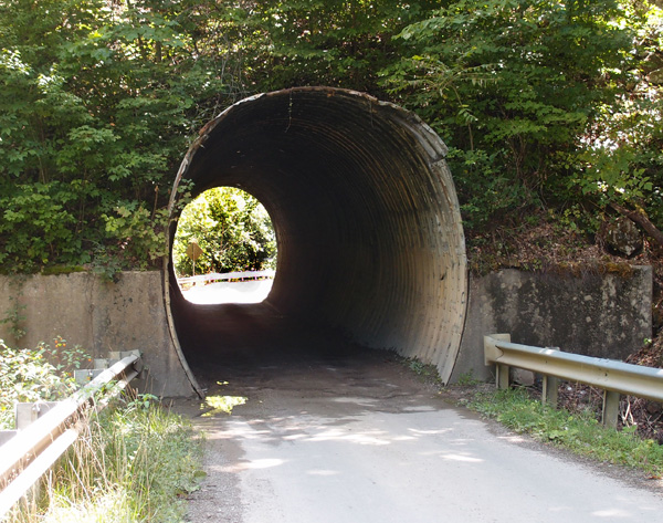
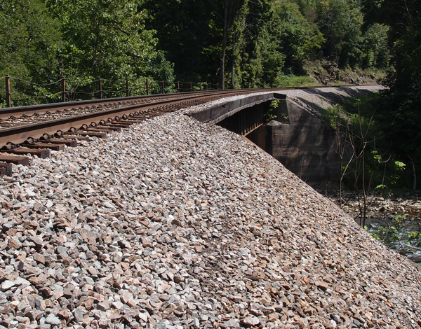
This bridge is west of the one above. It’s at 36.81457, -83.28791. It’s between Chevrolet and Grays Knob KY (looking NE)

Bridge over Martins Fork (KY)
This is one of three deck girder bridges over Martins Fork in Harlan County KY between Chevrolet and Cawood. They were constructed in 1928 by the Bethlehem Steel Company in Bethlehem PA. This line is active CSX, but I suspect the line was put in by the L&N. There’s a spur line, now dead, just north of here at Lenarue that parallels (sort of) Hwy 990 up to the Mary Helen mines.
This particular bridge is just off Hwy 3001 over Martins Fork. It’s about 280′ long.

Rail Real Photo Postcards
These three are real photo postcards; that is, one-off postcards made by Kodak from negatives sent in by camera owners. The photo of the N&W hopper and the two crew cars can be dated to between 1904 and 1918, as can the shot of the steam locomotive. The one of the crane resetting a CC&O derailment is from the 1918-1930 period. There is no other identifying information on any of these cards. I think they’re fascinating and I snapped them up as soon as I saw them.

Reedy Creek Bridge
This is original to the line, as far as I can tell. The date (1907) is right. This two span concrete bridge for the CSX (formerly Clinchfield) over Reedy Creek is just off Industry Drive in Kingsport, near the new roundabout on Netherland Inn Road. (There’s a new span that takes the line over Center Street as it intersects Netherland Inn Road. I vaguely remember the old span, which was just a two-lane overpass. There are remnants of the old concrete structure still in place up on the line.)
This span actually no longer carries the weight of the line, it’s been strongly reinforced. It you go by this now, you’ll see the Greenbelt covered bridge going through the left span.
Overpass Summerville Road
Spruce Pine NC old railroad station
Coming out the tunnel
This is Brush Creek (thanks, Jon Hirst!) tunnel between Green Mountain and Red Hill NC, on Green Mountain Road…all west of Bakersville. Funny thing about tunnels: you can be more or less in the center of a short tunnel where you can see bright daylight from each portal, but where you’re standing, it’s pitch black.
For all you pons pontis-ophiles out there
Neat, closed-to-traffic, concrete arch bridge was made by Luten Bridge of Knoxville in 1918. This goes over Puckett Creek at Stone Creek and used to connect St. Charles Road with what was then the highway between Pennington Gap and points north. It’s very near the intersection of Highway 421 and St. Charles Road just north of Pennington Gap. Here it is (this is looking from the highway side). A tip of the bald guy’s cap to Lee Stone for spotting this one.
Cowan Gap tunnel
Frisco Yard, VA
Old Interstate bridge
This gem of a McClintic-Marshall Company (Pittsburgh PA) 1922 deck girder is on the old Interstate line between Norton and Coeburn. It’s original, since this line was constructed in 1923 or so. It crosses an active N&S line and the Guest River. Surprisingly, the rail on the bridge is dated 2011 and it seems to have had moderate use. It centers at 36.94253, -82.58283 and it’s maybe 260′ long.
#36 Brush Creek tunnel
I’ll be damned if I didn’t miss a tunnel in all that scouting along the CSX line between Erwin and Altepass. My buddy called me a couple of days ago and said he’s spotted a tunnel on the topo that we hadn’t been to…it was on the Toe River, just west of Loafers Glory NC. I went up on Google Earth and located it at 36.00598, -82.23743. It’s in Goforth’s book at 163.11 miles south of Elkhorn City. I’ve looked at that list a dozen times and completely missed this tunnel. The tunnel is 304′ long on a curve and completely unfinished, except for some supporting concrete on the left of the south portal. Strong stone there, for sure. Here’s the south portal and the mile marker just before the south portal.
Highline tunnel, north portal
Here it is, the north portal of the Highline tunnel near Cawood KY at 36.78308, -83.24311. It’s one of three tunnels between Cawood and Smith KY (where Hagan tunnel’s north portal is). This one is a little over 1,200′ and curved, so you can’t see the other end from here. Note the lack of facing, indicating that the rock here is strong. The line is active. And, as you see from the mile marker, 251 miles from somewhere.


Clover Branch tunnels
Go northeast on 38 from Harlan KY for just under a mile and you’ll see these tunnels.

We didn’t know what to make of them, so, when I got back, I did a little research. They’re an Army job. Finished in 1992, these four tunnels divert the Clover Fork of the Cumberland River away from downtown Harlan, where there had been a history of flooding, into Martin’s Fork. The tunnels here are at 36.85526, -83.31546. The one the left carries the most water, normally. The actual input portals are at 36.85125, -83.31086, about 2,000′ away to the northeast going under Ivy Hill. The four tunnels minimize the possibility that one will get clogged up with debris in a flooding situation. Those who canoe or kayak say that these tunnels are safe, with smooth bottoms and moderate flow. The rock around the tunnels has been sprayed with concrete to stabilize it. You never know what’ll turn up in Kentucky.
Center Street Bridge, Kingsport
I’ve bought a new negative/slide/print scanner. It does pretty good for the price ($109)(it’s an SVP)(China). While looking through some old color negatives, I came across this one that I’d taken maybe 25 years ago. This bridge, which spans the fabled Reedy Creek (as in that legendary perfume “Reedy Creek Mist”) and the Greenbelt, was replaced by the City a couple of years ago. I hope someone kept this. The plaque is hard to read in this resolution and size, but here’s what’s on it: Federal Works Agency/Public Works Administration/John M. Carmody/Federal Works Administrator/Franklin D. Roosevelt/President of the United States/Center Street Bridge/1939.
Parlous times, those were. Probably quite a few men were damn glad to get a chance to work on this bridge.
1917 underpass near Glade Spring
At this point, Highway 751 passes under the Norfolk-Southern line that comes out of Marion VA. The concrete on this underpass is beginning to show its age. Interestingly, there’s a wye at Glade Spring, just west of here. We’re at 36.79238, -81.74222, with the main highway behind yr. hmbl. photographer. The date “1917” is stamped into the concrete above the right underpass.
#31 Sensabaugh tunnel
The plan today (9/1/13) was to head up to Sensabaugh Hollow, scramble (again) up the fill to the railbed and retake Sensabaugh and Click tunnels, which are within a half-mile of each other. Now, we’d checked the radar and we had seen an area of rain moving in, but we figured it was at least thirty minutes or so away. Wrong again. Just after I finished taking the picture below, we heard thunder, turned around to look north and saw the storm moving in. We looked at each other and said, almost in unison, “It’s a washout!” We got back to the car just as heavy rain began.
Sensabaugh, by the way, is the first tunnel on the CSX line going north from Kingsport (this is a southerly view). It gets its name from the small stream that runs down this hollow.

Double tunnels near Cawood KY
The CSX line (former L&N) going above these two underpasses is active. It comes down from Harlan and heads into Hagan Tunnel. The dating on the faces of the tunnels on this line is 1930. Since the date on the culvert between these two tunnels is 1951, I suspect (and will readily accept correction) that these probably date to around that time, more than likely replacing a timber structure. This is the former railroad underpass:
This was a line that branched off a line through Cawood and came through here on the way to Three Point, where there were three drift (deep) coal mines. Back when the railroad was here (it’s now County Road 1705), the depth of the ballast would have made the tunnel look less intimidating. This is centered at 36.774076, -83.243284.
This is the auto underpass, just next to the above. It’s at 36.773738, -83.243456.
This would have been the vehicular access (Rt. 991) to Three Point.


