Devon Tunnel

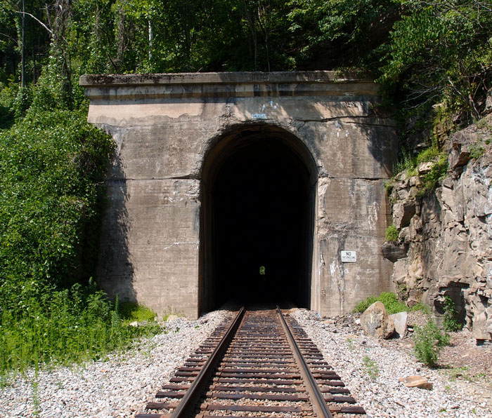
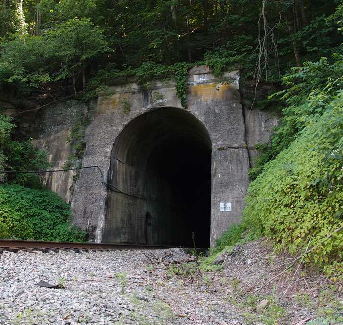
First it was timber that drove the railroads, narrow gauge lines, into Buchanan County VA.  The timber baron W. M. Ritter ran Shay engines and a few passenger cars along with his freight cars, the Big Sandy & Cumberland Railroad, all over Knox Creek, up the hollows and, eventually, on into Grundy.  When the N&W line took it all over in 1923, they had a problem.  N&W was standard gauge.  Shay engines can do a 6% grade, slowly, but the big non-geared wheels of the steam engines couldn’t.  The N&W opened its company coffers and rebuilt the line to reach the rich coal beds in the area.  They built a wye over the Tug Fork from the Pocahontas Main Line and constructed this tunnel, Devon Tunnel.  This north portal is at 37.52763, -82.04658.
OLYMPUS DIGITAL CAMERA


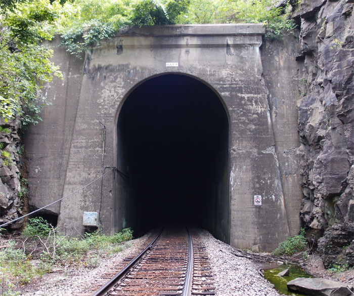
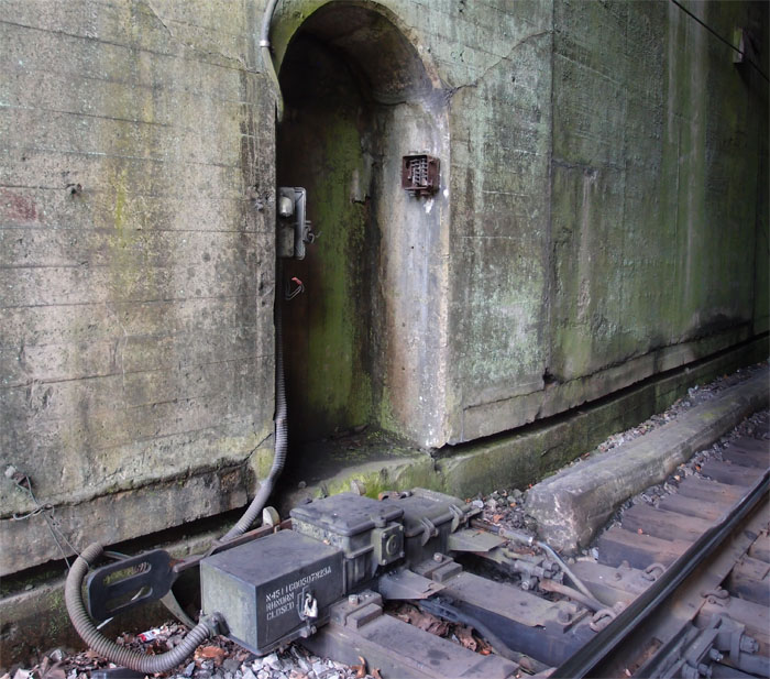
You can see in the above picture, on the left wall of the tunnel, a niche.  Apparently, there was once a manual switching unit there.  It’s all controlled now remotely.  Here’s a better look at the mechanism.
OLYMPUS DIGITAL CAMERA


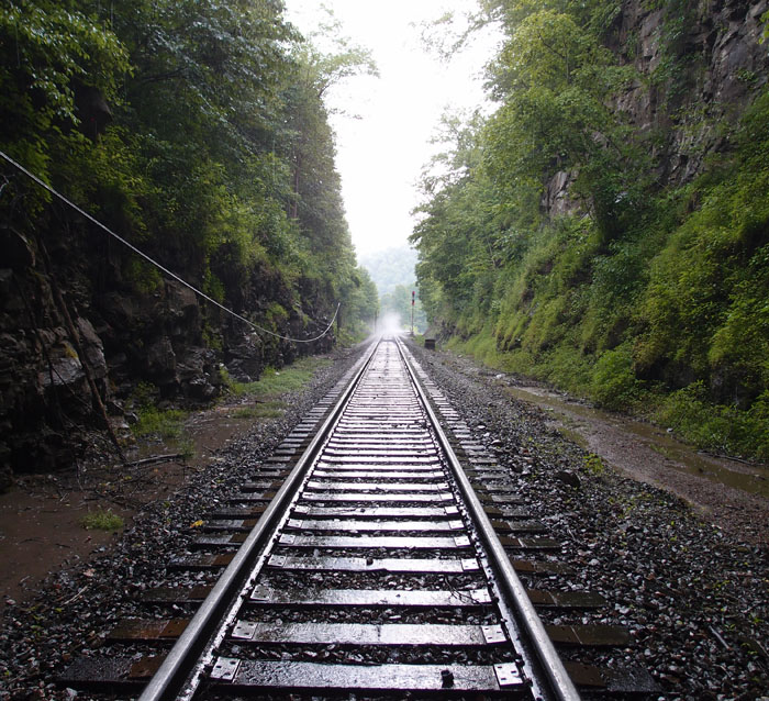
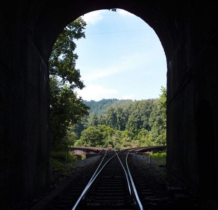
And, my favorite picture, looking out of the portal to the deck girders forming the wye over the Tug Fork.

OLYMPUS DIGITAL CAMERA


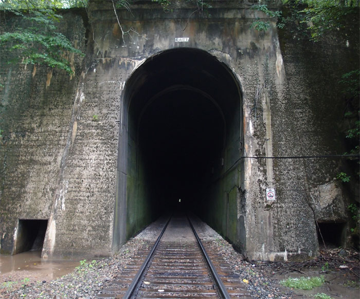
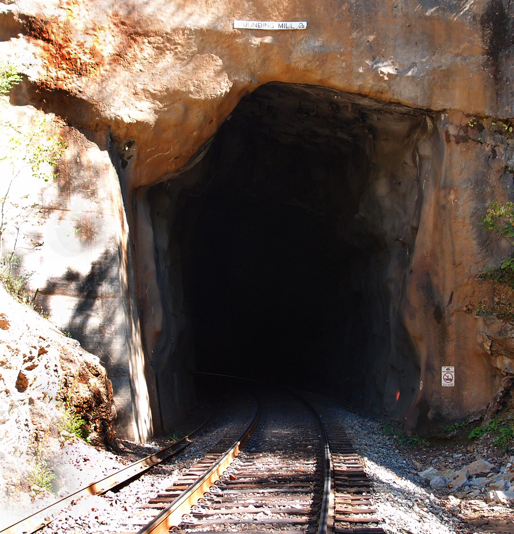
On the other side, about 1700′ back, is the south portal, a little more worse for wear.  The date on both is 1930.

OLYMPUS DIGITAL CAMERA

Raitt Tunnel

Raitt Tunnel was part of an expansion by the Norfolk & Western into the coal fields of Buchanan County VA.  It’s 3,700+ feet long and was completed in 1931.  This west portal is at 37.35168, -82.07228 between Big Rock and Hurley.  It’s just off the Highway 650 and, if you find the little trail down to it, it’s easy to get to.
OLYMPUS DIGITAL CAMERA


This is the east portal  (37.35408, -82.05974).  As I was walking up to it from the car, about 900 feet or so away, a sudden summer shower dropped a bucket or two of water on me.  I kept the camera dry with my cap, but I got wet.  The temperature that day in the sun was around 90 degrees and humid; the temperature at the portal was maybe 15 degrees cooler.  The second picture is taken from the portal of the mist rising from the hot tracks after the cool rain.
OLYMPUS DIGITAL CAMERA


OLYMPUS DIGITAL CAMERA

Pounding Mill tunnel #2

This is Pounding Mill tunnel #2, looking easterly.  It’s centered at 37.078653, -81.738603 and is about 377′ long.  A straight line distance from tunnel #1 is a little over a mile, but probably along the line of 2 miles if you walked the track, which we didn’t.  And we had a very hard time finding this tunnel and #3, since Google Earth, of which we are not worthy, made a teensy error, labeling Estates Street as Ash Street and we were totally lost.  Lee was hungry, it was nearing noon, so he suggested we give it up and head over to a nearby Wendy’s so he could get one of their baked potatoes.  I rarely eat potatoes, so I stayed outside, propped up against the car, looking at the topo map to see if there were any other way to get down to where those tunnels are.  An SUV pulled up.  The driver, a man, leaned over his passenger, a women, and asked, “What are you looking for?  I might be able to help you.”  I took the topo over and was pointing out where we needed to go to both the man and, as it turned out, his wife.  She took one look at the map and said, “That’s where my parents live.”  As I batted away the angels singing around my head, I explained that we needed to find Ash Street.  The man said that they’d changed the name of it to Estates Street.  Problem solved.  He called ahead, got permission for us to cross his father-in-law’s land to get to the railroad and the tunnels.  When Lee came out of Wendy’s with his food, I told him what was going on and he just laughed and shook his head. “Who would believe it!”

So, here’s tunnel #2.  It probably looks pretty much as it did 120 or so years ago.

Pounding Mill tunnel #1

We’re about halfway between Cedar Bluff and Claypool Hill in Tazewell County VA.  This is on an N&S line from Bluefield to Norton.  It’s the first of three.  It’s centered at 37.078360, -81.746409 and is about 545′ long.  This line came through between 1887 and 1890.  We’re heading up to the UrCoal region: Pocahontas, but we’ve got a couple more tunnels to check out.