The Loops: 2nd Rocky

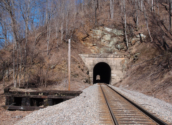
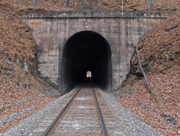
Just about 770′ to the south of 1st Rocky is 2nd Rocky.  It’s 757′ long. This south portal is at 35.865584, -82.004314.  The date on the refurb portal is 1918. You have to get permission to cross private land to get to both 1st Rocky and 2nd Rocky and there are two ways to get to them after that.  Fairly easy.  4th Rocky is a long trek away.  Believe me.

OLYMPUS DIGITAL CAMERA


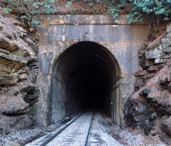
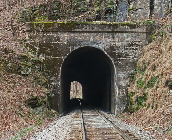
This is the northern portal of 2nd Rocky.  The date is partly eroded. I can see 192, but the fourth numeral is gone.

OLYMPUS DIGITAL CAMERA


Off the beaten path, again

We were coming into Burnsville NC on 221, when my buddy spotted these off the side of the road, sitting with several junked school buses and trailers.  I did a fast u-ey so we could stop and get pix.  I think, maybe, possibly, the red one, an industrial locomotive, is an old GE diesel.  The yellow one, which features an automobile engine, looks maybe locally adapted from another unit.  I couldn’t find a citation for “N.P. R.R.” nor for the “B. (W?). R. R.” that’s in faded, fancy lettering on the hood of the yellow one.  Bless ’em.  They probably worked hard in their day.
n.b. in reference to the comments below, this article on Wiki

OLYMPUS DIGITAL CAMERA

OLYMPUS DIGITAL CAMERA

The Loops: 1st Rocky

I’m posting these tunnels as they descend to Marion NC, but the pictures weren’t taken sequentially.  This was of necessity, since we’ve taken about four trips to figure out ways to get to these often isolated works of man.  This last Sunday was my long anticipated “that’s a wrap” trip.  We got the two tunnels that finished off the quest to photograph the 54 tunnels between Elkhorn City and Marion NC (there were 55 tunnels, but 3rd Rocky was opened up in 1977…there would have been 56, but the Ashford Cut couldn’t support a tunnel – and a gracious thanks to Dr. Brown for that piece of information).  So, here we are at 1st Rocky, 716′ long and this, the southern portal, located at 35.869675, -82.006134.  This tunnel, which is the first on the long glide down to Marion, is so named because it’s rocky.  The platform to the left, (see comment below)

OLYMPUS DIGITAL CAMERA

The Loops: Lower Bridal Path

This 1,618′ tunnel lies a tangent in The Loops that features a total of four tunnels (Lower Bridal, Speedy, Lower Pine, and Byrd Ridge).  Coming from Elkhorn City (about 193 miles away now), the track has just competed the first big loop and is going northeast into this, the southwestern portal.  This was taken in winter, but, in summer, it’s beautiful up here.

lowerbridal

The Loops: Snipes

Going almost due north after the bend, Snipes tunnel, the south portal, is at 35.843095, -82.034873.  It’s 637′ long and sits at 2,368′ above sea level. I don’t have any information on the name Snipes.  I thought it was named after a geographical feature, but after going over the maps again, I can’t verify that.  It’s dated 1916.
OLYMPUS DIGITAL CAMERA