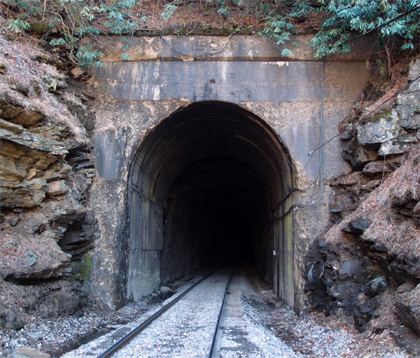
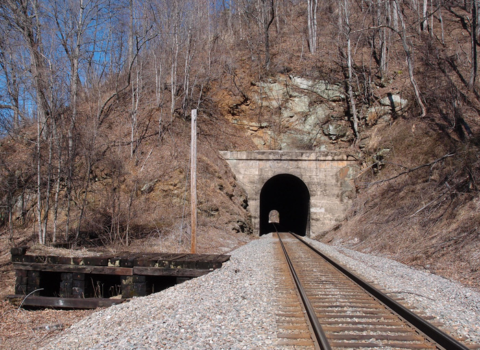
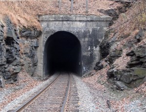
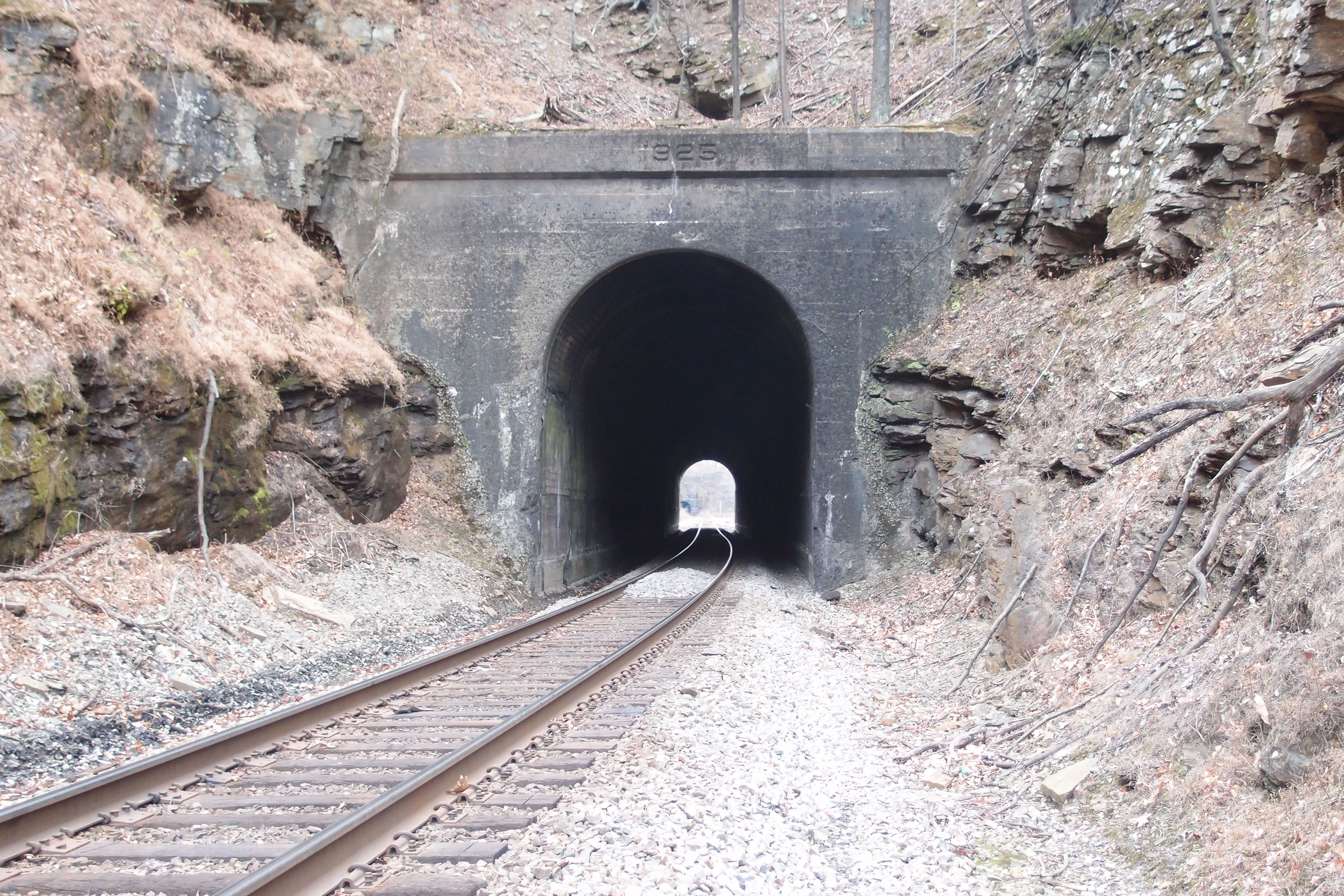
Imentioned in an earlier posting that 3rd Rocky tunnel (centered at 35.85881, -81.99896), was opened up, according to Goforth, in 1977. It was originally about 420′ long. As Butch Adkins commented, this was to widen the area to extend a siding track, not due to any instability of the ridge.
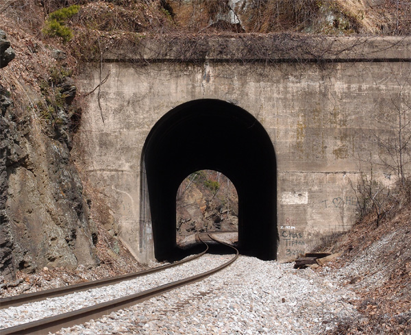
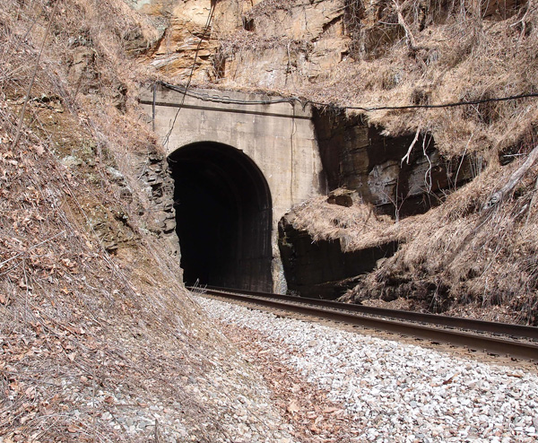
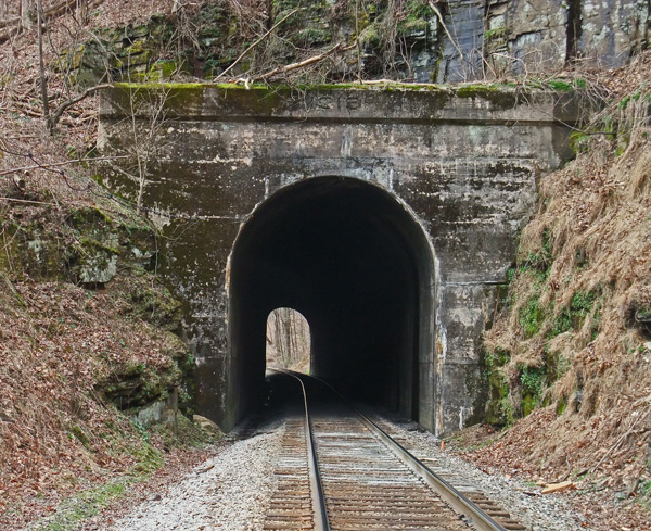
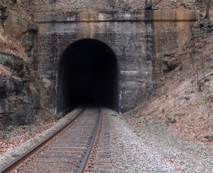
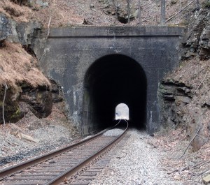
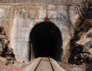
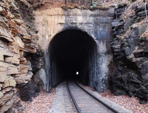
This, however, is the very sturdy 4th Rocky tunnel, just 179′ long. This southwest portal is at 35.863089, -81.990881. No visible date on the lintel. We were rather tired by the time we got to this tunnel, having walked from 2nd Rocky down past the remnants of 3rd Rocky. It was only about 2 miles, but, then it was 2 miles back.
The Loops
The Loops: 2nd Rocky
Just about 770′ to the south of 1st Rocky is 2nd Rocky. It’s 757′ long. This south portal is at 35.865584, -82.004314. The date on the refurb portal is 1918. You have to get permission to cross private land to get to both 1st Rocky and 2nd Rocky and there are two ways to get to them after that. Fairly easy. 4th Rocky is a long trek away. Believe me.
This is the northern portal of 2nd Rocky. The date is partly eroded. I can see 192, but the fourth numeral is gone.
The Loops: 1st Rocky
I’m posting these tunnels as they descend to Marion NC, but the pictures weren’t taken sequentially. This was of necessity, since we’ve taken about four trips to figure out ways to get to these often isolated works of man. This last Sunday was my long anticipated “that’s a wrap” trip. We got the two tunnels that finished off the quest to photograph the 54 tunnels between Elkhorn City and Marion NC (there were 55 tunnels, but 3rd Rocky was opened up in 1977…there would have been 56, but the Ashford Cut couldn’t support a tunnel – and a gracious thanks to Dr. Brown for that piece of information). So, here we are at 1st Rocky, 716′ long and this, the southern portal, located at 35.869675, -82.006134. This tunnel, which is the first on the long glide down to Marion, is so named because it’s rocky. The platform to the left, (see comment below)
The Loops: Byrd to Lower Bridal to Speedy
The Loops: Lower Bridal Path
This 1,618′ tunnel lies a tangent in The Loops that features a total of four tunnels (Lower Bridal, Speedy, Lower Pine, and Byrd Ridge). Coming from Elkhorn City (about 193 miles away now), the track has just competed the first big loop and is going northeast into this, the southwestern portal. This was taken in winter, but, in summer, it’s beautiful up here.
The Loops: Snipes
Going almost due north after the bend, Snipes tunnel, the south portal, is at 35.843095, -82.034873. It’s 637′ long and sits at 2,368′ above sea level. I don’t have any information on the name Snipes. I thought it was named after a geographical feature, but after going over the maps again, I can’t verify that. It’s dated 1916.
The Loops: 3rd Washburn
We’re now a little over 191 miles from Elkhorn City. We’re at the southernmost point of the first of The Loops, about a quarter mile past Quinn Knob tunnel. 3rd Washburn is a curved tunnel, 915′ long. This is the western portal at 35.839883, -82.037946. The date on the lintel is 1913. Snipes is next, but, as I said, we’re heading down to Norris Lake for an interesting series of tunnels (if you’re into tunnels). We’ll get back here real soon. The tunnels will still be here.
The Loops: Quinn Knob
As the CSX heads down the Blue Ridge, it makes the first Loop, curling around to come back to about 100′ away from the tangent that leads into it (but 132′ lower). Coming out of 2nd Washburn, about 1/4 mile away to the south, lies Quinn Knob tunnel, 545′ long. It carries a 1912 date on this south lintel at 35.841637, -82.041630. It’s on a slight bend, leading to 3rd Washburn, which we’ll get to shortly. Then we’ll take a break and gaze at four tunnels down on Norris Lake. Ever hear of the Knoxville, Cumberland Gap & Louisville Railroad? It was involved in the breaching of Cumberland Gap for the mighty steel rails. More later.
The Loops: 2nd Washburn
2nd Washburn, 370′ long, is on a 2,000′ straight stretch between 1st Washburn and Quinn Knob, where the track begins to loop back to the northeast. This is the north portal (35.847448, -82.044323) of 2nd Washburn with a 1925 refurb date (same on the southern portal).
The Loops: 1st Washburn
This is 1st Washburn, just about a half-mile down the line from Upper Bridal Path. The tunnel is 770′ long and has a slight curve. This is the southwest, lower, rather eroded portal at 35.848998, -82.044190 or so. It and the two other Washburn bores carry the name of Washburn Ridge.
The Loops: Upper Bridal tunnel
About a mile or so southwest of Upper Pine Ridge tunnel, lies Upper Bridal tunnel. It’s a curved tunnel, which mimics the curve of the Blue Ridge Parkway to the northwest of it. The tunnel is fairly easy to get to, if you know what you’re doing. This weathered southwest portal is at 35.855180, -82.035674. The tunnel is 927′ long. Around 1905 or so, nine workers were killed here when someone accidentally ignited 15 cases (100 pounds each) of dynamite (according to Ashton Chapman in the Charlotte Observer 8/23/53). Seven workers were killed on the same day, in another area, when a cut they were working on collapsed.
The Loops: Upper Pine tunnel
As we go sliding down the mountain, the 927′ Upper Pine (Ridge) tunnel appears…this is the northeast portal at 35.867468, -82.022427. It’s 1,600′ long.
The Loops: Blue Ridge tunnel
This is the east portal of Blue Ridge tunnel (35.883516, -82.018091), also noted on maps as Ridge tunnel. It’s 1,865′ long and goes under the Blue Ridge Parkway. The far end up there is 187.28 miles from Elkhorn City KY. After Vance, this is the first tunnel heading down the eastern slope of the Blue Ridge mountain.