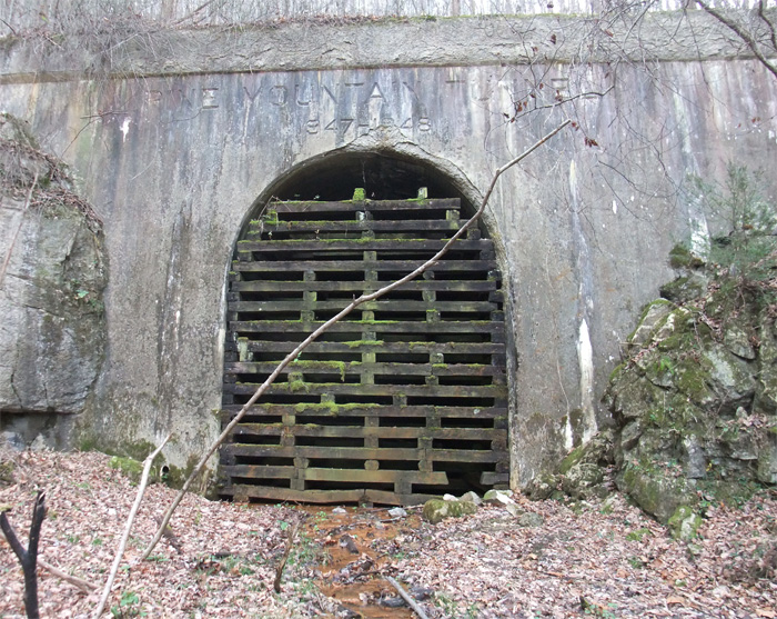
Just a couple of days ago, a person who had visited this blog sent me some extremely valuable information on the Pine Mountain tunnel, bored in 1947-1948 from Jenkins KY over to the Virginia side of Pine Mountain. The C & O was eager to open up a vast, 300 million ton, coal field just east of Pound. The tunnel was completed in 1948 and was out of service by 1958. The east portal, which I’ve posted before, is more or less open, if you like slogging in waders to get through to it. This west portal, near Jenkins, was boarded up rather thoroughly (although I’ve had at least one person comment that they had gone through it). Thanks to a photo by Chris Balthis, I know that this portal is well reinforced with concrete. The literature indicates that this side of the mountain wasn’t as stable as the east side. Look closely and you’ll see the inscription above the tunnel. They did things like that then…now they just throw tunnels up and slap some concrete on them. Hmmph, kids these days…
Anyway, I thought I’d posted this western portal. I hadn’t. Error corrected.
Month: May 2014
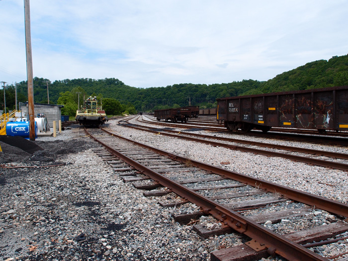
Loyall Yard, KY
First of all, Loyall Yard is pretty big. To get a look at it in its entirety, check Google Earth at 36.85470, -83.34902. The yard was built by the L&N in 1920 and originally had numerous tipples, a turntable and many other structures. The town of Loyall was once known as Shonn, which is local slang for “railroad siding” (Wikipedia). The yard and town are protected from Cumberland River flooding by a flood wall and gate.
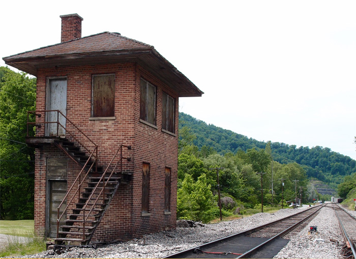
This structure, probably a control point of some sort is just east of Loyall Yard and is abandoned.
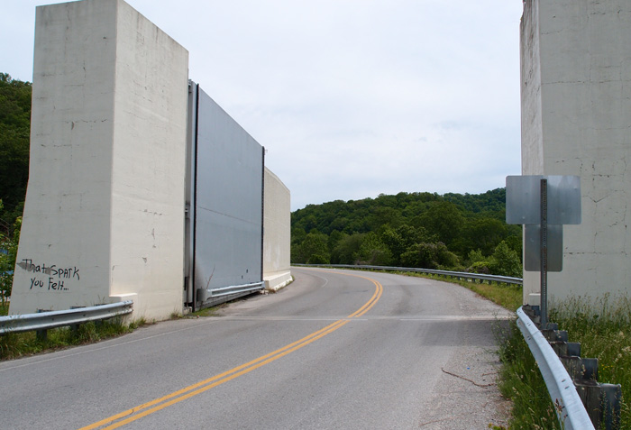
This is the flood gate on Highway 314 (the “Jerry Chestnut Highway”) coming into Loyall (this is looking east, away from Loyall).
This is a bit of Loyall Yard. The turntable used to be over on the right, past the row of hoppers.
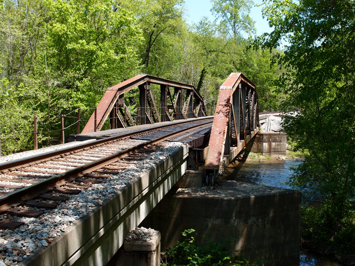
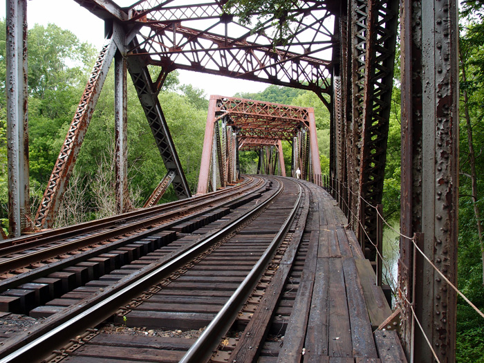
Kentucky truss bridge
This solidly built double-track 1925 Fort Pitt Bridge Works (Pittsburgh PA) structure spans the Cumberland River just west of CSX’s Loyall Yard. The bridge, in three sections, all box trusses (for a total of around 410′ in length), is at 36.85093, -83.36837. It’s on an active line that winds on into Pineville. This view is looking more or less west. To give you a sense of scale, that’s my buddy standing in the second section on the right hand side of the tracks.
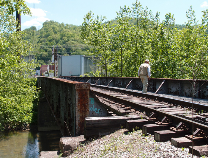
Harlan KY
This is a 1910 Louisville Bridge and Iron Company pony girder just off 421 going into Harlan from the south. CSX now owns this former Louisville & Nashville bridge over Martin’s Fork River. Beyond the bridge you can see the huge door that closes off this area in the event of flooding (which Harlan was very susceptible to)…it’s part of a 5,000′ long wall that protects the city from rising water. The flooding used to be worse, before they cut the three large tunnels to divert the Clover Fork River to near Baxter (see the tunnels here).
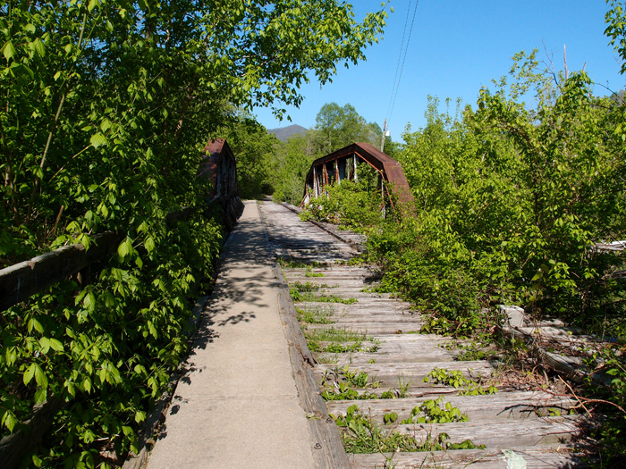
Two Kentucky bridges
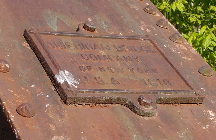
These two open camelback truss bridges, made by “American Bridge Co. of New York U.S.A. 1910” (the plates are the same on both…they’ve survived for 104 years!) are located on a dead L&N line that came out of Cawood KY and joined a line that came from Three-Point KY and moved on to Harlen and, probably, Baxter. The date is right to the line. I don’t know when this line went dead, but both these bridges have been converted to pedestrian use (people walked through the wet cement, scrawled their names and initials, but a date? Not going to happen.) This was part of the Cumberland Valley extension of the L&N that, through interchanges and leasing, heads Lynch and beyond (“To infinity and beyond!“).
This one’s just outside Cawood at 36.78422, -83.23707, looking generally west.
This is the date plate on the above bridge
This bridge is west of the one above. It’s at 36.81457, -83.28791. It’s between Chevrolet and Grays Knob KY (looking NE)