#31 Sensabaugh tunnel

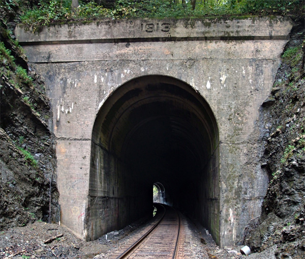
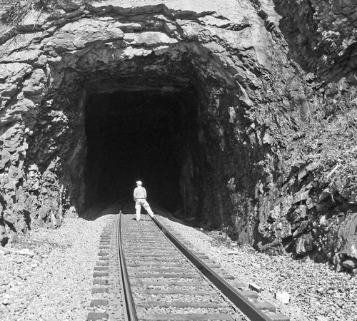
Located through Sensabaugh Ridge at 36.577409, -82.625001, this bendy little (348′)  tunnel is about a half mile south of Click tunnel, on the other side of Sensabaugh Valley, just a hop, skip and a jump from Beartown.  We’re almost 89 miles from Elkhorn City.  This view is looking south.  I found a really nice piece of quartz near here, but I didn’t keep it.  “Oh, joy, another piece of quartz.”

OLYMPUS DIGITAL CAMERA


#30 Click tunnel (now in color)

Early in the process of laying out the route of the railroad, engineers had to determine where to build trestles and where to fill in to keep the track on a steady grade.  When they came to the valley carved between Click Ridge and Sensabaugh Ridge, they opted to fill.  They built a concrete tunnel over Sensabaugh Hollow Road and Sensabaugh Branch (it runs through the tunnel).  Then, using the rock hewn out of the ridges for Click and Sensabaugh tunnels, they fashioned a 30′ or so high fill to keep the trackage at roughly 1300′ above sea level.  The fill spans the distance from Click tunnel and Sensabaugh tunnel (coming up next).  Coming out of Virginia into Hawkins County, you hit Click tunnel at 88.2 miles from Elkhorn City at 36.584876, -82.630481.  The tunnel is 608′ long and apparently has the original facing set in 1913.  There are stories about the road tunnel below the track being haunted, but, from what I hear, the locals think that’s hooey.  This picture was taken looking northward, with Sensabaugh tunnel to my back.
OLYMPUS DIGITAL CAMERA

#29 Clinch Mountain tunnel (now in color)

Clinch Mountain tunnel, in Scott County VA, at 36.637520, -82.735412 (center top of tunnel), is 4,135′ long. The date on the lintel is 1909.  If you have hawk-keen eyes, you might just be able to see the tiny speck of white near the bottom of the tunnel opening…that’s the other end.  It’s unfaced and just across Highway 23 from the Vulcan quarry in Speers Ferry, over a girder plate trestle.  The next picture is back on the Kermit side of the tunnel, just off to the right.  These are the ruins of a factory that was extant here in the early years of the last century.  It mined sand from up on the Clinch Mountain, processed it, and shipped it Pittsburgh Glass.  Odd to find that here…maybe it was super duper sand, or something.   Remnants of the rail siding are still visible (not in the picture)(sidings aren’t particularly interesting).

As of October, 2013, the ruins of the factory are still much the same, but heavily overgrown.  And, just as the last time, as I was taking this picture series (I’m just posting one), a CSX mixed-unit train came rolling through, generating enough wind in the cut to nearly take my cap off.

OLYMPUS DIGITAL CAMERA


Here’s the north portal of Clinch Mountain tunnel:
#29clinchnorth


#28 Speers Ferry tunnel

This tunnel is just west of Gate City VA at 36,647391, -82.744457.  It’s 1,116′ feet long and has an odd-looking south portal, kind of skewed.  Just back toward the highway from the tunnel is a quarry that you shouldn’t mess with, but is really an interesting place.  I’d tell you we walked all through the quarry, which is quite large and rather moonscapey (if you had a moonscape complete with a deep blue lake off to one side) and got some interesting pictures (which I’ll be posting on my other blog unclebobstravels at some time), but I can’t, since that would have been trespassing and such.  With this tunnel, we’re nearing the Tennessee line.  Up next, the 4,135′ Clinch Mountain tunnel, with an associated surprise.