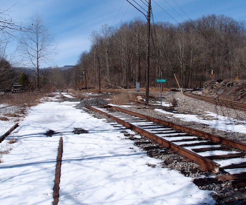
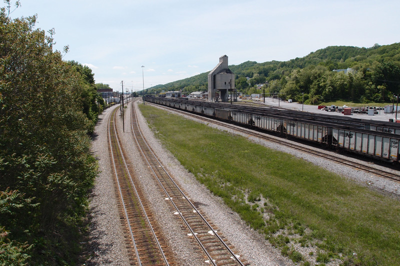
Nolichucky River Bridge (Unaka Springs)

bridgefacebridgeback

I think this card is from the early 20s.  I don’t know what company actually printed it (“published by Erwin Drug” just means that the drug store commissioned the postcard run).  American News Company of Boston farmed out a lot of the black-and-white work to Curt Teich in Chicago.  The inventory number does seem to indicate ANC.  However, I’m still working on this.  I have several cards in my collection that have the same back design and one seems to indicate it was done by Asheville Post Card Company.
Another maybe: this design often is shown with “COMMERCIALCHROME” AND “OCTOCHROME” in place of the “BLACK AND WHITE” wording.  It gets complicated.
Whatever.  This bridge is a 1907 replacement for an earlier timber structure and is, according to Goforth, is a TPG, a through plate girder style built on stone piers (possible: Goforth had access to original construction data and may have been using the TPG abbreviation to mean “timber plate girder”). It’s 864′ long.  This view is looking back toward Erwin. Note the steps up to the railroad grade.
This is the same bridge in 2014 (36 05 56.8N, 82 26 34.9W – Google Earth coordinate data entry):

The bridge is now a through pony plate girder and the piers are still there, but have been added on to in order to raise the level of the track.  There are houses on the left of this,at Unaka Springs, but no stairs.

Lonesome Valley Road Trestle

Looking up at the northwest end of the trestle, which is about 708′ long and around 100′ high, over Lonesome Valley Road in Claiborne County TN.   Here’s the southeast end:


This is on the same Norfolk Southern line I discussed in the Oakman tunnels posting.  This trestle, old as it appears, was most certainly a replacement or reinforcement of an existing trestle.  The original concrete footers are still there.

Mudlick Junction

OLYMPUS DIGITAL CAMERA

Ladies and germs, welcome to Mudlick Junction, about halfway between Stonega and Andover, snuggled between Stonega Road and Roda Road.  The two lines on the left are, obviously, dead and I think originally went to the mines at Roda.  The line on the far right is live and runs up to strip mines north of Stonega.

According to Hanson’s placename book, “Roda” is short for “rhododendron” and you have the Post Office to thank for omitting the “h” that should have been in “Roda”.  Andover is named in honor of Andover College in New England, which was of some significance to the president of the Virginia Coal and Iron Company.  “Stonega”?  Hanson says it’s just “Stone  Gap” without the “p”.  Ahh, ha.

“Mudlick” isn’t a placename.  It might have been a small settlement once.  A “lick” refers to an outcropping of salt that attracted wild animals and, eventually, hunters.  Meat and salt, all in one.

Industrial Locomotive

OLYMPUS DIGITAL CAMERA

I took this in 2012 on Old Mill Road in Glade Spring VA.  This old gentleman, obviously owned by a Dale Earnhardt fan, this is, I think, a GM DH-1 industrial locomotive from the 50s.  The hopper behind it is an old Southern Railway 91848 model.  The track here is a spur to a line that used to extend from a wye in Glade Spring up to Saltville.
On the back of the locomotive is painted “The Intimidator”.


Dante Turntable

OLYMPUS DIGITAL CAMERA

I finally got back to Dante Yard to take a few pictures of the long-disused turntable.  I had to clamber (and believe me, I clambered) up a hillside on the far side of the turntable to try to get the whole thing in frame.  I didn’t quite, but I got most of it.
Using a turntable like this saved a lot of time when you needed to get a locomotive (all 100 tons or so of it) turned around.
And the motor that did all the work wasn’t that big:
OLYMPUS DIGITAL CAMERA

Look at how rusty the tracks are:
OLYMPUS DIGITAL CAMERA

I wonder if it was good to have the title of “the guy who runs the turntable”?


Mudlick Junction

OLYMPUS DIGITAL CAMERA

This is what remains of Mudlick Junction, on the N&S.  The coordinates are 36.94037, -82.79725.  It must have been a busy place at one time. Now, however, the two lines on the left are dead.  I think the main line, center, went  to around Osaka VA.  The line to the far right is live, bringing coal out from a strip mine up past Stonega.  The junction is called Mudlick after Mudlick Creek, which flows nearby.
This was taken on a Sunday, but we saw many coal trucks moving in and out of the mine area and there was a N&S loco there with a string of hoppers getting loaded up.
Raus McDill Hanson writes in “Virginia Placenames and Derivations” that Stonega is just “Stone Gap” without the “p”.  I’m not getting any love from any of my reference materials or the web on the origin of the name “Osaka”, which I’m told is pronounced “Osakie”, as Stonega is often said as “Stone-agie” (long a, hard g).


The Tunnel With No Name

This tunnel could be called the Deane DTC This is Rockhouse Creek tunnel (see below: locals called it “Love’s Branch tunnel”).  It’s rudimentarily faced off, both portals and located near Democrat KY at 37 13′ 45″ N, 82 48′ 55″ W on County road 1048, just off Love’s Creek.  The tunnel is maybe 400′ long, with a curve to the east.  I don’t know what purpose was served by the two horn-like things on the north portal (see comment by Jon Hirsch).

South portal of the tunnel
North portal