Mudlick Junction

OLYMPUS DIGITAL CAMERA

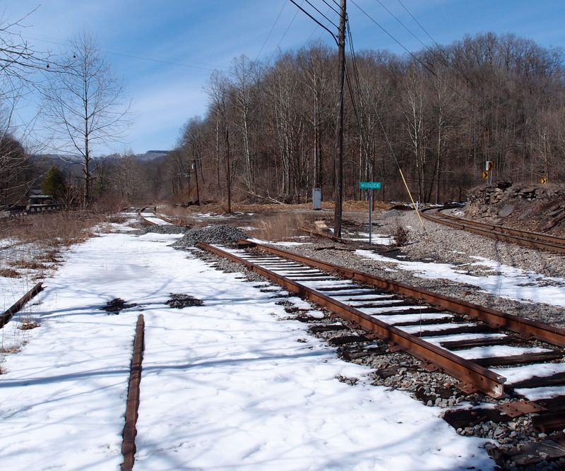
Ladies and germs, welcome to Mudlick Junction, about halfway between Stonega and Andover, snuggled between Stonega Road and Roda Road.  The two lines on the left are, obviously, dead and I think originally went to the mines at Roda.  The line on the far right is live and runs up to strip mines north of Stonega.

According to Hanson’s placename book, “Roda” is short for “rhododendron” and you have the Post Office to thank for omitting the “h” that should have been in “Roda”.  Andover is named in honor of Andover College in New England, which was of some significance to the president of the Virginia Coal and Iron Company.  “Stonega”?  Hanson says it’s just “Stone  Gap” without the “p”.  Ahh, ha.

“Mudlick” isn’t a placename.  It might have been a small settlement once.  A “lick” refers to an outcropping of salt that attracted wild animals and, eventually, hunters.  Meat and salt, all in one.

Mudlick Junction

OLYMPUS DIGITAL CAMERA

This is what remains of Mudlick Junction, on the N&S.  The coordinates are 36.94037, -82.79725.  It must have been a busy place at one time. Now, however, the two lines on the left are dead.  I think the main line, center, went  to around Osaka VA.  The line to the far right is live, bringing coal out from a strip mine up past Stonega.  The junction is called Mudlick after Mudlick Creek, which flows nearby.
This was taken on a Sunday, but we saw many coal trucks moving in and out of the mine area and there was a N&S loco there with a string of hoppers getting loaded up.
Raus McDill Hanson writes in “Virginia Placenames and Derivations” that Stonega is just “Stone Gap” without the “p”.  I’m not getting any love from any of my reference materials or the web on the origin of the name “Osaka”, which I’m told is pronounced “Osakie”, as Stonega is often said as “Stone-agie” (long a, hard g).