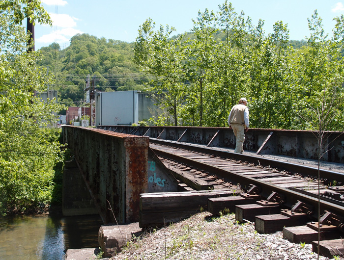
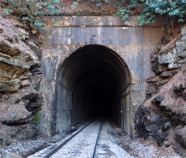
This is a 1910 Louisville Bridge and Iron Company pony girder just off 421 going into Harlan from the south. CSX now owns this former Louisville & Nashville bridge over Martin’s Fork River. Beyond the bridge you can see the huge door that closes off this area in the event of flooding (which Harlan was very susceptible to)…it’s part of a 5,000′ long wall that protects the city from rising water. The flooding used to be worse, before they cut the three large tunnels to divert the Clover Fork River to near Baxter (see the tunnels here).
CSX railroad
Bridge over Martins Fork (KY)
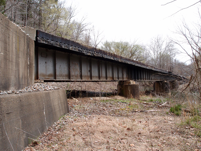
This is one of three deck girder bridges over Martins Fork in Harlan County KY between Chevrolet and Cawood. They were constructed in 1928 by the Bethlehem Steel Company in Bethlehem PA. This line is active CSX, but I suspect the line was put in by the L&N. There’s a spur line, now dead, just north of here at Lenarue that parallels (sort of) Hwy 990 up to the Mary Helen mines.
This particular bridge is just off Hwy 3001 over Martins Fork. It’s about 280′ long.
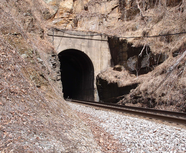
#54 Honeycutt tunnel
This eastern portal of Honeycutt tunnel is at 35.86638030, -81.969960. The tunnel is 1,688′ long and about a half mile or so west of the Ashford Cut. The reface date on the lintel is 1923. This, of course, is the penultimate tunnel on the line from Elkhorn City KY and Marion NC. I stood and looked at this tunnel for quite a few minutes, knowing this was the end of an over two-year project to document these tunnels. This was the last tunnel to be photographed, since we had gone into Marion two weeks earlier and had recorded the tunnel there. My buddy walked over to an outcropping over to the right of the line, back about 50′ or so, to investigate what appeared to be a cave. It wasn’t, but he found two stone cairns there. Since this tunnel is relatively isolated, I wonder if they were piled up by the workers here in 1907 – 1908. Could have been grave markers, too, since many men, often foreign labor, died blasting out these tunnels and doing the hard labor of laying a railroad.
#53 The Loops: 4th Rocky
I mentioned in an earlier posting that 3rd Rocky tunnel (centered at 35.85881, -81.99896), was opened up, according to Goforth, in 1977. It was originally about 420′ long. As Butch Adkins commented, this was to widen the area to extend a siding track, not due to any instability of the ridge.
This, however, is the very sturdy 4th Rocky tunnel, just 179′ long. This southwest portal is at 35.863089, -81.990881. No visible date on the lintel. We were rather tired by the time we got to this tunnel, having walked from 2nd Rocky down past the remnants of 3rd Rocky. It was only about 2 miles, but, then it was 2 miles back.
#51 The Loops: 2nd Rocky
Just about 770′ to the south of 1st Rocky is 2nd Rocky. It’s 757′ long. This south portal is at 35.865584, -82.004314. The date on the refurb portal is 1918. You have to get permission to cross private land to get to both 1st Rocky and 2nd Rocky and there are two ways to get to them after that. Fairly easy. 4th Rocky is a long trek away. Believe me.
This is the northern portal of 2nd Rocky. The date is partly eroded. I can see 192, but the fourth numeral is gone.
#40 The Loops: Upper Bridal tunnel
About a mile or so southwest of Upper Pine Ridge tunnel, lies Upper Bridal tunnel. It’s a curved tunnel, which mimics the curve of the Blue Ridge Parkway to the northwest of it. The tunnel is fairly easy to get to, if you know what you’re doing. This weathered southwest portal is at 35.855180, -82.035674. The tunnel is 927′ long. Around 1905 or so, nine workers were killed here when someone accidentally ignited 15 cases (100 pounds each) of dynamite (according to Ashton Chapman in the Charlotte Observer 8/23/53). Seven workers were killed on the same day, in another area, when a cut they were working on collapsed.

#39 The Loops: Upper Pine tunnel
As we go sliding down the mountain, the 927′ Upper Pine (Ridge) tunnel appears…this is the northeast portal at 35.867468, -82.022427. It’s 1,600′ long.

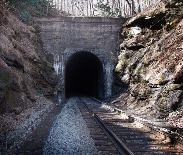
2nd Cawood tunnel
This tunnel, fairly short, is south of the Cawood KY tunnel on Bob’s Creek at 36.766159, -83.242214 (this is the north portal. The south portal is unfinished). A man who lives near this tunnel, after checking our religious credentials (we lied)(sorry), confirmed that the 1929 date on the tunnel is consistent with the building of this line. He also regaled us with stories of at least four people who died on the railroad for various reasons (drunk, stupid). That stuff rolls off our backs like duck water.


#37 Vance tunnel
Here’s the requisite picture of Vance tunnel (35.895091, -82.024390, 2721′ elevation, 527′ long), just across a ditch and a fill from Altepass Baptist Church (can’t miss it, there’s a big red caboose sitting across from the church). These tandem engines are heading back toward Tennessee.


Here, however, is a shot of the above portal, showing the 1907 date. Once I’d scrambled up the fill to the track and trotted down to get this pix, I turned around and saw that I could have just as easily walked in from a crossing just up the way. But, then, there’s some romance somewhere in carefully stepping across a green, slightly greasy, little stream and then, crab-like, making my way up a fill. Most of the time it works fine…

#34 Free Hill tunnel
Gray, TN, used to be called “Gray Station”. There was a train station right about where the big telemarketing building is now. Just to the east of that location is the 41′ or so narrow ridge that the railroad had to tunnel through to maintain grade. Thus: what is known now as Free Hill tunnel. It’s a 472′ jobbie that quite a few people who work and live around the area don’t even know is there (and they probably don’t care, either). There are also two single-lane concrete railroad overpasses in the area, indicating that there were extant roads in the early 1920s (they also carry 1927 dates). But they didn’t carry a lot of traffic, or cars were a heck of a lot narrower then. Anyway, here’s the tunnel’s EC (west) portal.
 tunnel EC side")
A Sidebar on rails
Non-continuous steel rails were often dated when forged or extruded or whatever the hell they were. The date isn’t stamped into the rail, but is a bas relief, like this one on a siding rail between the old Holston Glass and Holston Distributing buildings in Kingsport. The date is 1920. Trust me.


In Dante yard, in the old area around the turntable, the track was more recent. 1927, t’be exact.


This is near to the earliest we’ve seen. The Kingsport track, assuming it was laid down within a year or so after it was forged/extruded/whatever, dates to near the time that the city was re-chartered in 1917. I stand there and wonder what the area looked like then. Pretty thin on the ground, I’ll bet.
Wrecked locomotives


