Bob Lawrence
Fremont
This is the original location of the Fremont train station in Dickenson County VA:
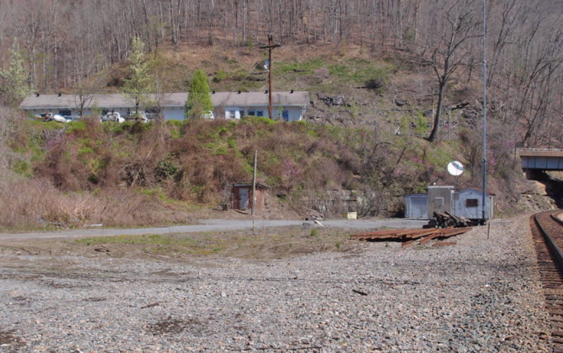
As the railroad went up to Moss mine, Fremont became a busy place…built in 1915. Sometime later, a giant grabbed the depot and put it on the hill. Up there is Fremont Avenue (Highway 83 which wends its way between Clintwood and Clinchco. On the other side of the tracks, across a rather heavy-duty bridge over the McClure River, is Highway 63 which takes you to, surprise!, McClure.
The renovated depot, by the way, looks great and continues to well serve the people who travel in this area.
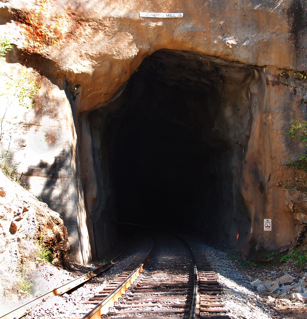
Pounding Mill tunnel #2
This is Pounding Mill tunnel #2, looking easterly. It’s centered at 37.078653, -81.738603 and is about 377′ long. A straight line distance from tunnel #1 is a little over a mile, but probably along the line of 2 miles if you walked the track, which we didn’t. And we had a very hard time finding this tunnel and #3, since Google Earth, of which we are not worthy, made a teensy error, labeling Estates Street as Ash Street and we were totally lost. Lee was hungry, it was nearing noon, so he suggested we give it up and head over to a nearby Wendy’s so he could get one of their baked potatoes. I rarely eat potatoes, so I stayed outside, propped up against the car, looking at the topo map to see if there were any other way to get down to where those tunnels are. An SUV pulled up. The driver, a man, leaned over his passenger, a women, and asked, “What are you looking for? I might be able to help you.” I took the topo over and was pointing out where we needed to go to both the man and, as it turned out, his wife. She took one look at the map and said, “That’s where my parents live.” As I batted away the angels singing around my head, I explained that we needed to find Ash Street. The man said that they’d changed the name of it to Estates Street. Problem solved. He called ahead, got permission for us to cross his father-in-law’s land to get to the railroad and the tunnels. When Lee came out of Wendy’s with his food, I told him what was going on and he just laughed and shook his head. “Who would believe it!”
So, here’s tunnel #2. It probably looks pretty much as it did 120 or so years ago.
Pounding Mill tunnel #1
We’re about halfway between Cedar Bluff and Claypool Hill in Tazewell County VA. This is on an N&S line from Bluefield to Norton. It’s the first of three. It’s centered at 37.078360, -81.746409 and is about 545′ long. This line came through between 1887 and 1890. We’re heading up to the UrCoal region: Pocahontas, but we’ve got a couple more tunnels to check out.

Dry Fork tunnel #1
This is Dry Fork tunnel #1 (37.234365, -81.639281), about 470′ or so. This is looking north from the trestle over the Rift-Berwind Road and Dry Fork River in West Virginia. Bridge facing date is 1912, with a 1911 date on the trestle abutment. Pending further research, I’d say the line here dates to the late 1800s, when the coal mines began to open up. Our general theory with the lines in the area is that they blasted out the tunnels, leaving them unfinished if they were stable and ran the line over timber trestles until either the trains got heavier or the timber began to deteriorate, then they switched to the current configurations. It’s a theory.

Dry Fork tunnel #2

Dry Fork tunnel #2, centered at 37.222078, -81.633671. It’s about 478′ long. 1912 date. Thanks go to Lee Stone for the picture…I was still fussing with my camera after taking the dusty slide…plus, I wasn’t interested in climbing a long fill again. Wonder why? As of this date, it doesn’t bother me at all.
Dry Fork tunnel #3
This is a long one. It’s 4,688′ or so and centered at 37.152524, -81.693367, near Bandy VA. Interesting design on this portal. Since I’d just made a production of sliding on my belly down the 30′ or so embankment coming up here, I wasn’t in the mood to trudge over to the other portal to check it. You can, if you want to.

Meadowview VA train station

Yeah, it’s not a tunnel, but I’ve gotten interested in documenting the remaining train stations in our area. Some are pretty tarted up and some are gone. Some have character.
This one, which appears to be on the road to renovation, is in Meadowview VA. It’s pretty much standard issue train station.
The railroad came to Meadowview around 1856 and kept the community prosperous until the 1950s. Meadowview, also known as Meadow View, is near Whitetop Mountain.
Dry Fork tunnel #4
We’re just off Hwy. 627 about a mile south (as el cuervo flies) of Bandy VA. This tunnel is centered at 37.128412, -81.699718. It appears to be about 501′ long. There’s a trestle a little bit past this northern portal that goes over 627, but, since I lost my notes on this journey, I don’t recall the date on the trestle. Btw, I’ve replaced both the voice recorder and the eTrex with newer models. I tried them out last Sunday as we explored the old town of Bulls Gap…first railroad there was built by slave labor in 1857.

Dry Fork #5
We started in Cedar Bluff VA, working our way up the N&S line toward Rift WV. There are five tunnels along the way. It was a hot day. I ended up taking a belly slide down the shaley embankment off a rail line (I was nearly to the top of the 35′ embankment when the loose dirt crumbled away from my foot and down I went, clutching a small tree that I had grabbed, hoping for a little braking, but I got breaking) and getting a fair amount of scratches (two on the lens of my Nikon, prompting my buddy to remind me about, you know, a skylight filter to protect the lens…). Then, to top if off, a few tunnels on, I absent mindedly left my Olympus voice recorder and my eTrex on the trunk of my car and then drove away. God knows where they are. But, I’ve got replacements ordered. Paraphrasing a saying by my boss, “If you’re going to be stupid, you’ll have to pay.”
This is Dry Fork tunnel #5, centered at 37.109438, -81.723611. This is looking more or less south. By the Google Earth ruler, it appears to be about 790′ long. 1912 date, as you can see. This line could be far older than this date, since N&W could have done a full refurb of the line in 1911-1912 (there are these dates firmly on trestles and tunnels on this line), facing the tunnels and replacing old timber trestles.


#37 Vance tunnel
Here’s the requisite picture of Vance tunnel (35.895091, -82.024390, 2721′ elevation, 527′ long), just across a ditch and a fill from Altepass Baptist Church (can’t miss it, there’s a big red caboose sitting across from the church). These tandem engines are heading back toward Tennessee.


Here, however, is a shot of the above portal, showing the 1907 date. Once I’d scrambled up the fill to the track and trotted down to get this pix, I turned around and saw that I could have just as easily walked in from a crossing just up the way. But, then, there’s some romance somewhere in carefully stepping across a green, slightly greasy, little stream and then, crab-like, making my way up a fill. Most of the time it works fine…

ET&WNC tunnel #5 Doe River Gorge
If you come into the Gorge from the Railroad Grade Road side, this one’s easy to miss. The west portal of tunnel #5 is completely filled in and only the remains of the cut can be seen…look

