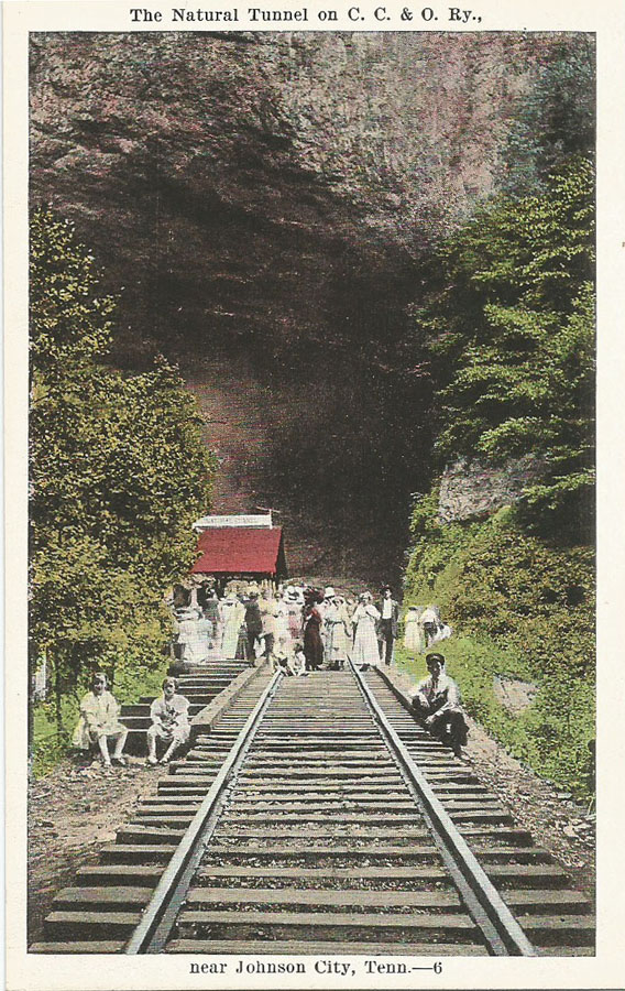
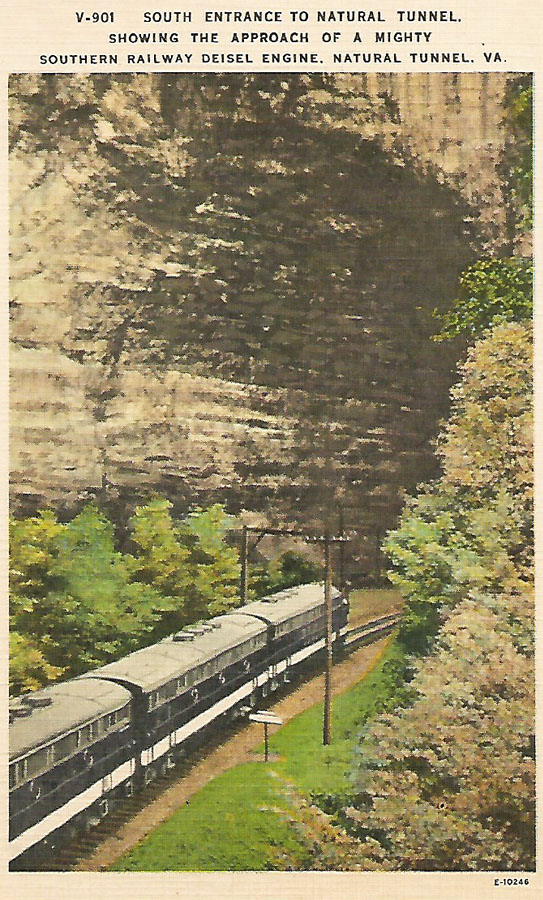
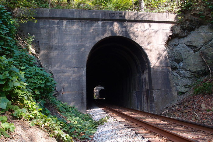
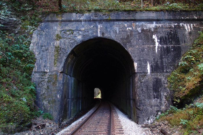
King Bridge

OLYMPUS DIGITAL CAMERA

This Clinchfield Railroad trestle is only King Bridge Company (Cleveland OH) unit I’ve found.  Made in 1907.  That’s the Clinch River it’s crossing (no, it’s not..see below.  It could be Cove Creek, though).  This deck girder is just off Hwy. 65 south of Ft. Blackmore in Scott County VA.

Southern Diesel

nattunnel

“V-901   SOUTH ENTRANCE TO NATURAL TUNNEL, SHOWING THE APPROACH OF A MIGHTY SOUTHERN RAILWAY DEISEL ENGINE, NATURAL TUNNEL, VA.”  Yeah, they misspelled “diesel”.
The plate number is E-10246

On the reverse:

The Natural Tunnel, located on U.S. Highway 23, 14 miles west of Gate City, Virginia, in Scott County, is said to be the only Natural Tunnel in the world used by a railroad.  Through it the Southern Railroad has hauled many million tons of coal from the rich deposits of Southwest Virginia.

(Kodachrome by Robert Suttle)

In pencil:  1951

Published by Asheville Post Card Co., Asheville, N.C.

Natural Tunnel x 2

These are both early shots of Natural Tunnel, near Duffield (sort of) in Virginia.  This first one is an E.C. Kropp (Milwaukee) card.  These people are obviously celebrating something.  The sign on the red-topped building reads “Natural Tunnel”.  There are no power poles visible.  I would guess that the original picture (it was in black and white; the color was added at the printing company) dates to the first quarter of the 20th century.  Note that the railroad is listed as “C.C. & O”.
nattunneloldforweb


This is a somewhat newer card, an Asheville Post Card Company issue.  On the back:  “The Natural Tunnel, located on U.S. Highway 23, 14 miles west of Gate City, Virginia, in Scott County, is said to be the only Natural Tunnel in the world used by a railroad.  Through it the Southern Railroad has hauled many million tons of coal from the rich deposits of Southwest Virginia. (Kodachrome by Robert Suttle)”
Note that there are now power poles through the tunnel.

nattunnelnewerforweb

#24 and #25: The Twins (Now in Color)

Located in Scott County VA, where the Clinch River makes a wide bend, these two tunnels bypass it by cutting through two close ridges.  The North Twin (308′) is 71.26 miles south of Elkhorn City (quickly vanishing in the distance, well over the horizon, lost in Kentucky).  The South Twin is just a few feet beyond the North.  If you were standing between them, you’d be at 36.709679, -82.646909 and an elevation of 1343′.  South Twin is just 236′, a mere slip of a tunnel.  The first picture is the south portal of South Twin, looking north to the North Twin.  The second picture is the north portal of North Twin, looking south to the north portal of South Twin.  They’re both dated 1912.

OLYMPUS DIGITAL CAMERA


OLYMPUS DIGITAL CAMERA