Heading south, we’ve gone from Shannon tunnel in Russell County past the Guest River Gorge, past the old Miller Yard (it was quite a place in its day), to Townes tunnel in Scott County. It’s 1,098′ long. It’s at 36.851101, -82.436563. This view looks northerly, toward Miller Yard. This is an unusual horseshoe shaped tunnel, but the shape is related to the stress lines along the line of the tunnel. There was a train collision in this tunnel back in the day. It’s said you can still see the scars of the wreck inside the tunnel. I didn’t check, sorry. Starnes is next, then The Twins.
Author: Bob Lawrence
#21 Shannon tunnel
We’re now 47.6 miles from Elkhorn City, between St. Paul and Carfax VA in Russell County at 36.890949, -82.354993. The first picture is the horseshoe-shaped EC side portal of Shannon tunnel, 820′ in length, cutting through a ridge in an oxbow of the Clinch River. The horseshoe cross-section is deliberate, required, research tells me, by ground conditions in the area. This tunnel is not dated, but there is an impolite reference to CSX spraypainted on the lintel. The next picture is of the south (actually west) portal of the tunnel taken from the 300′ or so trestle that takes the CSX over the Clinch River on to Townes tunnel.
May Town tunnel
Here’s Swede May Town tunnel. This northern portal is located at 36.936982, -82.465540 in Coeburn VA. It was constructed in 1922 as the Interstate Railroad ran a line up from Miller Yard through Guest River Gorge to Coeburn and points beyond. It went out of service in the ’60s and all the trackage has been removed. It’s around 639′ long and muddy. We wore waders to get through it. Just behind where I was standing to take this picture is Adams Street bridge.
Btw, the Guest River Gorge trail is a great hike and there’s even one small tunnel on the way (Swede tunnel). It’s not far down the trail, but it’s a little over 5 miles to the Clinch River from the trailhead, it’s a long, long 5 miles back up. Each mile is marked with a sign and, as you’re coming back up, the signs seem to get farther and farther apart. We’ve done it on bikes and on foot. Bikes are recommended, believe me. Or a helicopter.
#19 Martin tunnel
This is the Elkhorn City portal of the Martin tunnel on the CSX…29.87 miles from Elkhorn City. The tunnel, at 37.041013, -82.308243, is 387′ long and, as you can see takes a turn to the right before opening out very near a community called Wakenva. The story is that this town was established by a coal company that had interests in West Virginia, Kentucky and Virginia. I don’t know how you get “West Virginia” from “Wa”, but that’s just me. The date over the portal is 1920.

Hagan tunnel (L&N)
This is the Hagan tunnel southern portal about 10 miles west of Pennington Gap at 36.706559, -83.288597 in Lee County VA. The tunnel, over 6,000′ long, runs from Hagan through Cumberland Mountain to Chevrolet KY, originally as part of L&N’s Cumberland Division. The tunnel was constructed in the late 1920s. There is also a single reference to another tunnel here at Hagan breaching the mountain higher up in a private or community effort back around the turn of the 20th century. It was used by wagons for commerce between the states (we couldn’t find it).
This place is also interesting in that there are the two wyes (I was corrected on this…it’s a switchback) near this portal. The CSX train comes over the top of the tunnel entrance going in a westerly direction, moves off to the first switchback, then backs down to the other one, which allows it to head into the tunnel going more or less northward. All very complicated and a headache, I’ve read, for CSX, but since this is a lightly used, low speed line, they feel the cost of clearing all this up would not be profitable. It takes about an hour for the train we observed to make the complete transition. This was (I’m guessing) a 90-car unit. At that length, it was completely in the tunnel before it came out the other side (math – coal car: about 50′ or so and the two engines about 75′ each…making the train about .8 mile in length).

#18 Buffalo tunnel
Well, here we are at Buffalo tunnel, 26 miles south of Elkhorn City. The tunnel bores 352′ through a ridge where the railroad, which has been heading in generally easterly direction for a few miles, kinks sharply (for a railroad) to the south. We’re by the McClure river, a bit north of Nora, in Dickenson County. Decimal coordinates: 37.080040, -82.351309.

#17 Caney tunnel
#16 Pettit tunnel
This is Pettit tunnel, just south of Clinchco and Squirrel Camp tunnel (so named, it’s said, because squirrel was about all the tunneling crew had to eat while they worked there). It sports a 1928 dating. Nice, sensible tunnel, 379′ long at 37.133940, -82.369548, just off Highway 63 (revisited). This was one of those “Well, here it is. Take a picture. Okay, what’s next?”. Next is Caney Fork tunnel, that’s what. Squirrel’s actually pretty good, btw. Mom used to make a killer fried squirrel with gravy. 
#14 Short Branch tunnel
This is Short Branch tunnel, just south of Reinhart. It’s located by the McClure River (I think that Short Branch is a creek somewhere in the area) and is 913′ long at 37.152285, -82.372719. The reface date on the portal is 1930. This is looking toward Elkhorn City and that’s me heading up to take a look into the tunnel. On the way across the creek by an old, low concrete bridge, we saw an amazing group of butterflies on the shore. The picture is titled “Butterfly Airport”. Butterflies, I found out later, have an affinity for dung heaps. I feel differently now about butterflies.
The Tunnel With No Name
This tunnel could be called the Deane DTC This is Rockhouse Creek tunnel (see below: locals called it “Love’s Branch tunnel”). It’s rudimentarily faced off, both portals and located near Democrat KY at 37 13′ 45″ N, 82 48′ 55″ W on County road 1048, just off Love’s Creek. The tunnel is maybe 400′ long, with a curve to the east. I don’t know what purpose was served by the two horn-like things on the north portal (see comment by Jon Hirsch).
Pine Mountain tunnel, Part Two
We felt we really hadn’t made enough effort to document the eastern portal of Pine Mountain tunnel. My buddy acquired two sets of waders. And we needed them. The distance is short, but the way was uncomfortable in a number of ways. There were some sort of reeds that were dead, but towered well over our heads. See the picture of Lee (my hiking buddy) as scale.
There were also briars, cold water as deep as a couple of feet, with mud a little deeper…oh, and downed trees across the way. Not complaining, you understand, because seeing the portal was informative. James Goforth in “Building the Clinchfield” (ISBN 1-57072-191-9) says that Pine Mountain is located in “a highly disturbed fault area”. When I looked into the portal (on left), I saw what 53 years of neglect has produced: the roof of the tunnel is falling in. With a strong light, Lee was able to see more rockfalls further down.
We also saw where all the water was coming from. The water is blocked from coming into the tunnel by a 4′ or so high cinder block wall just at the portal entrance.
After we sloshed and squished out to the car, we went over to Jenkins to access the western portal, but came to a locked gate. We decided that we’d had enough mud for this day and promised to come back later. However, I did take a shot of the abutment of a railroad bridge that apparently crossed an existing road as the line went on down into Jenkins.
#13 Reinhart tunnel
Here it is, Reinhart tunnel, 617′ long and with a 1924 refacing. It’s just across a trestle over Hwy 63 from Perkins tunnel. It centers at 37.157979, -82.372536. When I checked this tunnel out on Google Earth, I noticed that there’s an obvious track of the tunnel in the overburden. That was the first time I’d noticed that, but it happens with nearly all tunnels, unless the overburden is quite thick.
#12 Perkins tunnel
Here we are at Perkins tunnel and, as you can see, we’re 18 miles from EC. It’s 496′ long and was refaced in 1917…the date’s clear, but I went for the scenic shot, so you really can’t see it in this picture (but you do get to see the neat mile marker). This tunnel is at 37.161187, -82.370361, about .5 mile west of Clinchco.

#15 Squirrel Camp tunnel
Since I mentioned Squirrel Camp tunnel (668′), I’m posting it. It’s close to Sykes Mill tunnel, anyway…near Clinchco on the McClure River. 1929 is the refurb date. When we got to this tunnel, we realized that we didn’t know when the next train could be due…they were running at about a half hour apart, we thought. We didn’t want to be inside the tunnel when a train came through, so my hiking buddy, ever the optimist, suggested we just circumvent the tunnel by going around it on the river side. He even thought he saw a trail down there. About a hundred feet in, we realized there wasn’t even a trail down there, but we decided to push ahead. It was probably a little under a mile around to the other side, through dense undergrowth, bushes, small trees, large trees, damp glop and other lovely stuff. I managed to crack the view screen on my camera ($100 to repair, fyi). But we made it and stood on the other side huffing and puffing and then it dawned on us that we hadn’t heard a train go through. And didn’t see another the rest of our time there.

Pine Mountain tunnel
This is the Virginia (eastern) portal of Pine Mountain tunnel, blasted out in 1947 and sealed up, at least from the Kentucky side, in 1958. It’s just off Highway 667 above Almira, if you’re coming out of Pound. The access is at the “Red Fox Trail” sign, but don’t expect an easy way in. The railbed is heavily overgrown with high marsh grass and there was a lot of marshy goop around. We leaped, gazelle-like, across a creek and climbed up to the top of the cut and pushed our way through trees, some briars, and other of Nature’s finest obstacles, to where we could get a fairly clear view of the portal. You actually can’t see it in either of these pictures, but on that light-colored band across the top of the portal is written “1947 PINE MOUNTAIN TUNNEL’.
The Chesapeake and Ohio railroad created this tunnel in order to open up a vast (300 million tons!) coal field just east of Pound VA. A big thank you to Chris Balthis for providing me some rich research material on this nearly forgotten tunnel.

#11 Sykes Mill tunnel
Here we are near Clinchco in Dickenson County, looking toward Elkhorn City (we’re about 16 miles now from that storied site). This is Sykes Mill tunnel, 752′ long, through a rock spur that runs down to the Clinch McClure River. This is convenient tunnel to photograph, since it’s practically sitting in your lap when you pull off 63 onto a side road that crossed the tracks. Not like Squirrel Camp, and I’ll tell you why later (it’s #15).
And thank you to Rodney Adkins, who corrected the error on the name of the river. He also added that this tunnel is near Clinchco.
And thanks to Jeff Brouws for catching my error on the miles from EC. Sykes is actually 16.78 miles…I had 11. Lost in the ozone again…
I originally had Clinchport as the locator…Jeff caught that. See above.

#20 Sandy Ridge Tunnel
This is the longest tunnel on the old CC&O. That little white dot in the lower middle of the tunnel is 7,854′ away. The other portal is actually refurbished, but I like this portal. It resembles the original facing that the Southern used on some of its tunnels…they’re usually dated about 1908 or so. Since this is another line, it may be more recent. This tunnel is just south of Trammel in Dickenson County, approximately 33 miles south of Elkhorn City. There is another Sandy Ridge tunnel, on the N&S, just 6+ miles to the northeast of this one. It also goes from Dickenson into Russell County.

Monuments to a rail line long gone
Between Burdine and Elkhorn City KY beside Highway 197 stand these monuments to a rail line long gone. They look freakishly like a pop art version of Stonehenge. The one on the left is not leaning precariously, that’s lens distortion. These are located at approximately 37.229696, -82.524684. The reason they line up like this is that the railroad crossed this highway at a sharp angle, but the piers had to allow for the roadway. This bridge was intact in 1996, but gone in 2000. It appears to have originally connected a mine area (later a strip mine) some miles to the north with an interchange near Burdine. The earliest image Google Earth has of this area was taken in 1995 (enable “historical imagery”). You can clearly see where this line went.
#10 Red Ridge Tunnel
16 miles south of Elkhorn City, 1,359′ from portal to portal. The refurb date has eroded away on both sides. We’re just south of Goff Tunnel, very near what turned out to be the now-lost town of Steinman. We had accessed the tunnel down a semi-private one-lane road, which went past a couple of houses. We pulled up to the railroad (CSX has access rights to the property, as we found out), got out and took some pix. On our way out, we saw a stern looking man watching us from the side of the road, near one of the houses. Judging this to be the property owner, we slowly stopped and Lee jumped out of the car with the topo map and began to explain what we were doing and pointing to the tunnel on the map. The man, surprisingly, looked relieved. “I thought y’all were hunting ginseng!”, he said. After that, things went swimmingly, with the man telling Lee that his mom (the man’s, not Lee’s), who lived right next door, was a amateur historian of the area. They proceeded on to the other house (I stayed in the car…this was Lee’s show and I wasn’t hearing any tunnel chatter) and had a ten-minute or so talk with the woman. That’s how we came to know about Steinman and the cable car system that brought coal from across the valley to be dumped into a tipple there at the town and later dumped into coal trains heading south to feed the mighty industries of the blah blah blah. On to Sykes Mill Tunnel.

Not a tunnel, but…
Well, there we were, hiking along a little-used line that runs from Appalachia to the strip mines above St. Charles. We’d parked at the location where a small town called Delvale once stood and started walking west to check out the four trestles we’d spotted along a two-mile or so stretch. These trestles are often dated with plates from the manufacturer, American Bridge Company. We were probably a mile or so from Delvale when Lee spotted this: two medium-size grist stones embedded into a concrete pedestal. There are no markings we could see on the pedestal. Lee’s foot is resting on the remains of a foundation, perhaps of the mill, but this location is, say, 50′ above the Powell river and there are no streams around…and no roads, either. And why were they mounted up like this? Enquiring minds want to know. In case you’re interested (yeah, right), this location is 36 48′ 40.2″ N 82 57′ 32.3″ W, more or less. (later: Lee, who has the topo for this area, happened to mention that “Mill Creek” runs right down by this location. Well, that makes sense.)
Up in Kentucky
This tunnel, on a CSX line from a large strip mine in Myra KY, is in Virgie KY. I backed off to show the chimney above the tunnel. The tunnel itself has been sprayed with quick-setting concrete and has rock bolt reinforcements all along its length. The line goes from here to the big rail yard at Shelbiana. Once, the line went south of Myra, but it’s just empty railbed now. There were plenty of short trestles on this line…every blessed one of them made by American Bridge Company in 1911. The company is still in business…and so are the trestles on the active line. The trestles on the dead line that don’t go over the 2-lane highway have been removed, but the locals say that, even though the railroad has to carry insurance on the extant trestles, they’re just too expensive to move, since they’d have to somehow reroute the traffic when the crane comes in to haul out these hunks of tonnage.
Big Bull tunnel
There are three tunnels on the Norfolk and Southern line between St. Paul northwestward to Coeburn. They’re all old tunnels and faced and dated at time of construction. This is Big Bull tunnel, centered at 36.917577, -82.359635. It’s about 1,500′ long. Date’s 1904. I particularly like how these tunnels were finished up. Nice stonework.
A Sidebar on rails
Non-continuous steel rails were often dated when forged or extruded or whatever the hell they were. The date isn’t stamped into the rail, but is a bas relief, like this one on a siding rail between the old Holston Glass and Holston Distributing buildings in Kingsport. The date is 1920. Trust me.

In Dante yard, in the old area around the turntable, the track was more recent. 1927, t’be exact.

This is near to the earliest we’ve seen. The Kingsport track, assuming it was laid down within a year or so after it was forged/extruded/whatever, dates to near the time that the city was re-chartered in 1917. I stand there and wonder what the area looked like then. Pretty thin on the ground, I’ll bet.
#9 Goff Tunnel
Wrecked locomotives

This is the front of 439.
This is the engineer’s control area…not badly damaged at all.
But whatever happened to these two engines must have been scary to be in.
Dante Yard
Just for fun, we stopped at the old Dante Yard to check out the locomotive turntable that used to operate there.
This is it. It’s a large circle and the interior part turns on a track. The track in the area (which is no longer used) is dated 1927. This whole complex must have been a happening place back in the day. We’re going to do some investigating of other rail operations in this area, including numerous narrow-gauge lines that serviced both the coal mines and the timber industry. Sounds like fun to me.
#8 Hewitt tunnel
This is Hewitt Tunnel, about 13.6 miles from Elkhorn City. This was the most difficult tunnel for us to reach, since we opted not to wade the McClure River (it would have been easier to do that…the river’s not really deep in that area), but to drive in on a road I’d spotted on Google Earth. The gravel road was about a mile downhill with drainage berms cut across the road a regular intervals. I got my Honda Civic over them with minimal scraping going down, but coming back was a white knuckler as the car spun in the gravel and failed to gain traction. With my buddy’s pushing and the little car’s gutsy (!) front wheel drive, we managed to get the job done, but my hands were shaking from adrenaline when we got back to the main road. I also found out later that all that spinning and stuff had basically destroyed my tires. It was time for new rubber, anyway.

#7 McClure Tunnel
#6 Russell Tunnel
This is Russell Tunnel, seen from the south side, with the impressive bluff above it. It’s 11.52 miles (at the other portal) from Elkhorn City. The tunnel is 448′ long and was refaced in 1921. We met an older man who was parked there on the road on the right. He said he just came up there to watch the trains go by. He’d worked on the railroad when he was younger. We wished him well and good train spotting. We’re still in Dickenson County, a little away now from Haysi. Next up: McClure Tunnel on the McClure River.

A Short Interruption
I want to make a few comments:
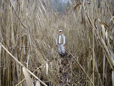
1) My hiking buddy and I are pretty practiced at slogging along railroad lines chasing down tunnels (well, finding them….after all, tunnels aren’t in the habit of moving around a lot). We’re skirting legality, too. Railroad companies are nervous lately, for good reason, I suppose, since they’re a critical infrastructure and there are pockets of really crazy people lurking out there. Anyway, all CSX property is posted. We’re careful, we never touch or move anything, and we get the hell out of the way of trains.
2) Speaking of which (trains, in case you lost track…lost track, get it…), trains are crazy heavy, run pretty darn fast most of the time, and on either side can extend around 12″ from the end of the ties, or sleepers. Give them plenty of room. The wheels squeal and a wheel with a flat place is noisy. The ground moves when the locomotives come by. They also include engineers, who know that if they see something ahead on the tracks, there isn’t even a teeny chance they’ll be able to stop that train quickly. Don’t let a train surprise you. They blow their horns often, though, and you can hear a train coming a quarter of a mile away, unless you’re on the opposite side of a bend (nervous, nervous).
There are plenty of rails-to-trails you can hike or bike…The Creeper in Abingdon or Damascus, the stretch of old L&N line that goes from Appalachia to Big Stone Gap (rails still there), Guest River Gorge Trail (fun going down…a beast coming back up), and various remnants of the old ET& WNC line from Johnson City to Cranberry NC, where the iron mines are that furnished the metal that was forged into the big guns of the Confederacy, way back when. The ore is magnetic, too. Wonder if you stood near one of those cannon with a compass, it would point gun?
I would never suggest that you go running the tracks taking pix. Anyway, in this area, we’re just about finished doing just that. Get your own project <grin>.
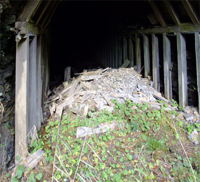
Next tunnel coming up: Russell.


